You are here: Home > Network List > IU - Global Seismograph Network (GSN - IRIS/USGS) Stations List
> Station JOHN Johnston Island, USA > Earthquake Result Viewer
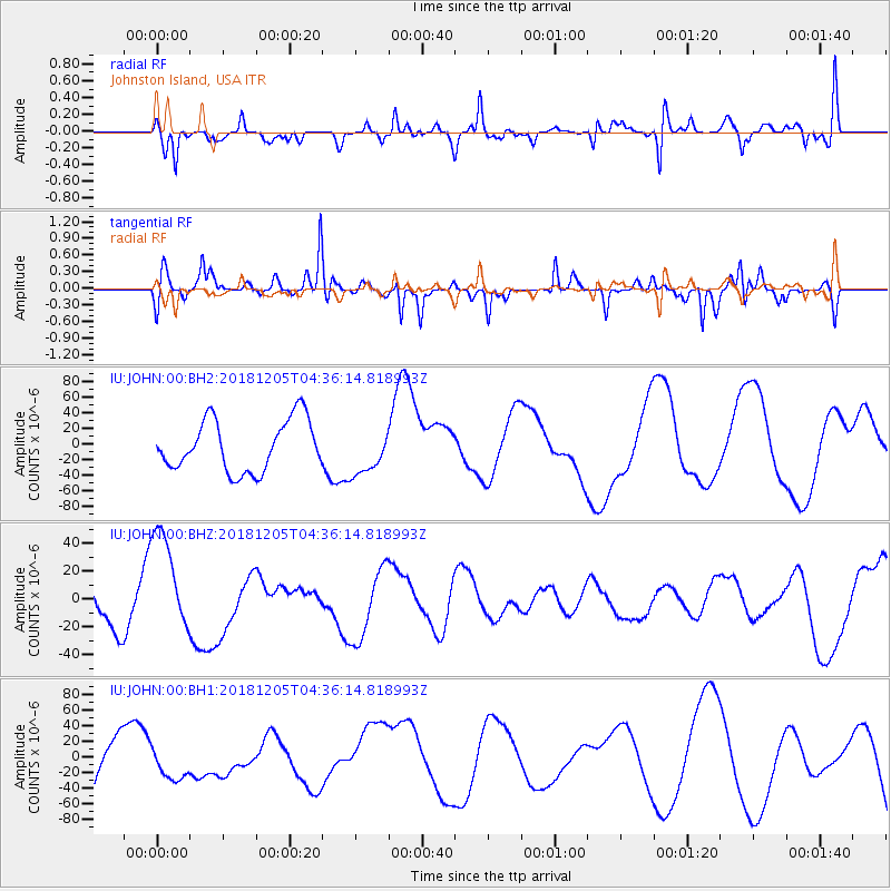
JOHN Johnston Island, USA - Earthquake Result Viewer
*The percent match for this event was below the threshold and hence no stack was calculated.
| Earthquake location: |
Southeast Of Loyalty Islands |
| Earthquake latitude/longitude: |
-21.5/169.4 |
| Earthquake time(UTC): |
2018/12/05 (339) 04:28:44 GMT |
| Earthquake Depth: |
10 km |
| Earthquake Magnitude: |
5.9 mb |
| Earthquake Catalog/Contributor: |
NEIC PDE/us |
|
| Network: |
IU Global Seismograph Network (GSN - IRIS/USGS) |
| Station: |
JOHN Johnston Island, USA |
| Lat/Lon: |
16.73 N/169.53 W |
| Elevation: |
2.0 m |
|
| Distance: |
43.3 deg |
| Az: |
30.217 deg |
| Baz: |
209.28 deg |
| Ray Param: |
$rayparam |
*The percent match for this event was below the threshold and hence was not used in the summary stack. |
|
| Radial Match: |
62.914276 % |
| Radial Bump: |
400 |
| Transverse Match: |
76.37993 % |
| Transverse Bump: |
353 |
| SOD ConfigId: |
3201911 |
| Insert Time: |
2018-12-19 04:30:29.058 +0000 |
| GWidth: |
2.5 |
| Max Bumps: |
400 |
| Tol: |
0.001 |
|
Signal To Noise
| Channel | StoN | STA | LTA |
| IU:JOHN:00:BHZ:20181205T04:36:14.818993Z | 2.1184535 | 3.9496117E-5 | 1.8643845E-5 |
| IU:JOHN:00:BH1:20181205T04:36:14.818993Z | 0.75627637 | 2.4157138E-5 | 3.194221E-5 |
| IU:JOHN:00:BH2:20181205T04:36:14.818993Z | 0.8861565 | 2.8796878E-5 | 3.249638E-5 |
| Arrivals |
| Ps | |
| PpPs | |
| PsPs/PpSs | |


