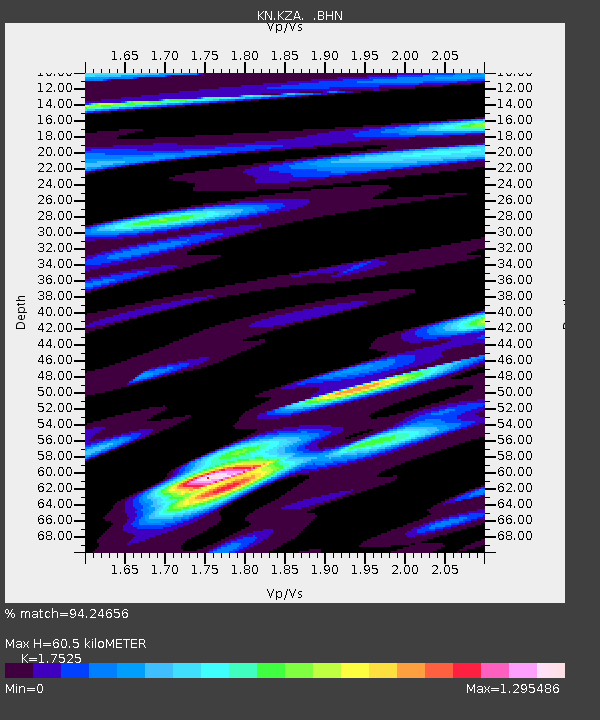
KZA KN.KZA - Earthquake Result Viewer

Earthquake location: Near East Coast Of Honshu, Japan
Earthquake latitude/longitude: 39.7/142.4
Earthquake time(UTC): 2010/07/04 (185) 21:55:51 GMT
Earthquake Depth: 27 km
Earthquake Magnitude: 6.4 MB, 6.1 MS, 6.3 MW, 6.2 MW
Earthquake Catalog/Contributor: WHDF/NEIC
Network: KN Kyrgyz Seismic Telemetry Network
Station: KZA KN.KZA
Lat/Lon: 42.08 N/75.25 E
Elevation: 3520 m
Distance: 49.6 deg
Az: 295.759 deg
Baz: 68.967 deg
Ray Param: 0.068550564
Estimated Moho Depth: 60.5 km
Estimated Crust Vp/Vs: 1.75
Assumed Crust Vp: 6.306 km/s
Estimated Crust Vs: 3.598 km/s
Estimated Crust Poisson's Ratio: 0.26
Radial Match: 94.24656 %
Radial Bump: 400
Transverse Match: 92.084496 %
Transverse Bump: 400
SOD ConfigId: 319893
Insert Time: 2011-01-05 00:05:10.180 +0000
GWidth: 2.5
Max Bumps: 400
Tol: 0.001

Signal To Noise

ChannelStoNSTALTA
KN:KZA: :BHZ:20100704T22:04:10.075001Z81.346823.3964022E-64.175212E-8
KN:KZA: :BHN:20100704T22:04:10.075001Z3.71931535.344549E-71.4369712E-7
KN:KZA: :BHE:20100704T22:04:10.075001Z10.45371.1232333E-61.0744841E-7
Arrivals
Ps7.6 SECOND
PpPs25 SECOND
PsPs/PpSs33 SECOND