MVL Millersville University, PA - Earthquake Result Viewer
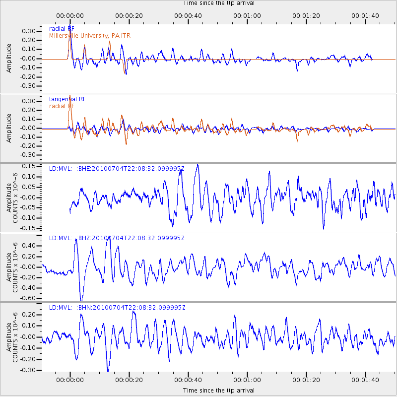
Earthquake location: Near East Coast Of Honshu, Japan
Earthquake latitude/longitude: 39.7/142.4
Earthquake time(UTC): 2010/07/04 (185) 21:55:51 GMT
Earthquake Depth: 27 km
Earthquake Magnitude: 6.4 MB, 6.1 MS, 6.3 MW, 6.2 MW
Earthquake Catalog/Contributor: WHDF/NEIC
Network: LD Lamont-Doherty Cooperative Seismographic Network
Station: MVL Millersville University, PA
Lat/Lon: 40.00 N/76.35 W
Elevation: 91 m
Distance: 93.2 deg
Az: 28.766 deg
Baz: 331.096 deg
Ray Param: 0.041308053
Estimated Moho Depth: 42.0 km
Estimated Crust Vp/Vs: 1.77
Assumed Crust Vp: 6.419 km/s
Estimated Crust Vs: 3.622 km/s
Estimated Crust Poisson's Ratio: 0.27
Radial Match: 85.8131 %
Radial Bump: 400
Transverse Match: 71.40013 %
Transverse Bump: 400
SOD ConfigId: 319893
Insert Time: 2011-01-05 00:06:33.625 +0000
GWidth: 2.5
Max Bumps: 400
Tol: 0.001

Signal To Noise

ChannelStoNSTALTA
LD:MVL: :BHZ:20100704T22:08:32.099995Z3.82233.533504E-79.244444E-8
LD:MVL: :BHN:20100704T22:08:32.099995Z3.6574891.2094328E-73.30673E-8
LD:MVL: :BHE:20100704T22:08:32.099995Z2.4760226.535017E-82.6393211E-8
Arrivals
Ps5.2 SECOND
PpPs18 SECOND
PsPs/PpSs23 SECOND