You are here: Home > Network List > US - United States National Seismic Network Stations List
> Station MNTX Cornudas Mountains, Texas, USA > Earthquake Result Viewer
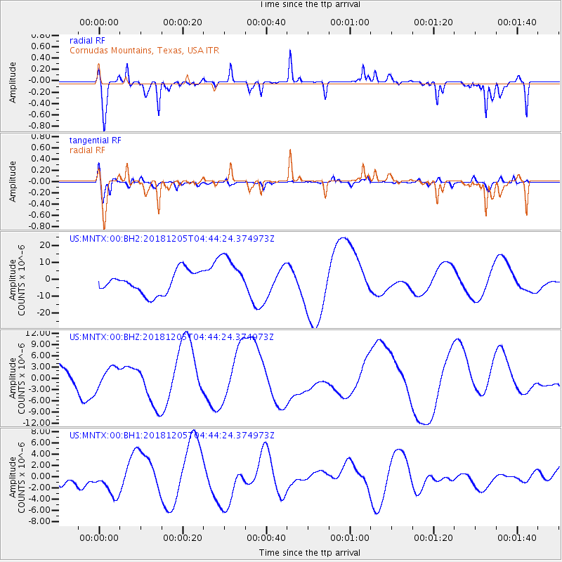
MNTX Cornudas Mountains, Texas, USA - Earthquake Result Viewer
*The percent match for this event was below the threshold and hence no stack was calculated.
| Earthquake location: |
Southeast Of Loyalty Islands |
| Earthquake latitude/longitude: |
-21.9/169.5 |
| Earthquake time(UTC): |
2018/12/05 (339) 04:31:23 GMT |
| Earthquake Depth: |
10 km |
| Earthquake Magnitude: |
5.6 mb |
| Earthquake Catalog/Contributor: |
NEIC PDE/us |
|
| Network: |
US United States National Seismic Network |
| Station: |
MNTX Cornudas Mountains, Texas, USA |
| Lat/Lon: |
31.70 N/105.38 W |
| Elevation: |
404 m |
|
| Distance: |
97.2 deg |
| Az: |
58.876 deg |
| Baz: |
248.878 deg |
| Ray Param: |
$rayparam |
*The percent match for this event was below the threshold and hence was not used in the summary stack. |
|
| Radial Match: |
42.876167 % |
| Radial Bump: |
260 |
| Transverse Match: |
50.526142 % |
| Transverse Bump: |
400 |
| SOD ConfigId: |
3201911 |
| Insert Time: |
2018-12-19 04:36:40.512 +0000 |
| GWidth: |
2.5 |
| Max Bumps: |
400 |
| Tol: |
0.001 |
|
Signal To Noise
| Channel | StoN | STA | LTA |
| US:MNTX:00:BHZ:20181205T04:44:24.374973Z | 1.0588195 | 2.679125E-6 | 2.5302943E-6 |
| US:MNTX:00:BH1:20181205T04:44:24.374973Z | 1.5191864 | 2.8004922E-6 | 1.8434157E-6 |
| US:MNTX:00:BH2:20181205T04:44:24.374973Z | 1.8932086 | 1.2452483E-5 | 6.577449E-6 |
| Arrivals |
| Ps | |
| PpPs | |
| PsPs/PpSs | |


