You are here: Home > Network List > US - United States National Seismic Network Stations List
> Station WMOK Wichita Mountains, Oklahoma, USA > Earthquake Result Viewer
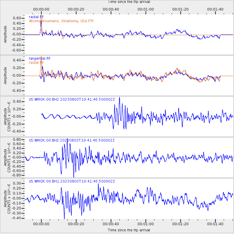
WMOK Wichita Mountains, Oklahoma, USA - Earthquake Result Viewer
*The percent match for this event was below the threshold and hence no stack was calculated.
| Earthquake location: |
Alaska Peninsula |
| Earthquake latitude/longitude: |
54.7/-161.0 |
| Earthquake time(UTC): |
2023/08/03 (215) 19:33:51 GMT |
| Earthquake Depth: |
41 km |
| Earthquake Magnitude: |
5.6 mww |
| Earthquake Catalog/Contributor: |
NEIC PDE/us |
|
| Network: |
US United States National Seismic Network |
| Station: |
WMOK Wichita Mountains, Oklahoma, USA |
| Lat/Lon: |
34.74 N/98.78 W |
| Elevation: |
486 m |
|
| Distance: |
46.8 deg |
| Az: |
88.624 deg |
| Baz: |
315.151 deg |
| Ray Param: |
$rayparam |
*The percent match for this event was below the threshold and hence was not used in the summary stack. |
|
| Radial Match: |
49.950626 % |
| Radial Bump: |
400 |
| Transverse Match: |
56.73754 % |
| Transverse Bump: |
400 |
| SOD ConfigId: |
31937991 |
| Insert Time: |
2023-08-17 20:01:55.080 +0000 |
| GWidth: |
2.5 |
| Max Bumps: |
400 |
| Tol: |
0.001 |
|
Signal To Noise
| Channel | StoN | STA | LTA |
| US:WMOK:00:BHZ:20230803T19:41:46.500002Z | 2.4240012 | 1.3357774E-7 | 5.5106305E-8 |
| US:WMOK:00:BH1:20230803T19:41:46.500002Z | 0.88174546 | 4.4548116E-8 | 5.052265E-8 |
| US:WMOK:00:BH2:20230803T19:41:46.500002Z | 1.9000282 | 6.5718524E-8 | 3.4588187E-8 |
| Arrivals |
| Ps | |
| PpPs | |
| PsPs/PpSs | |


