
K22A Casper, WY, USA - Earthquake Result Viewer
| ||||||||||||||||||
| ||||||||||||||||||
| ||||||||||||||||||
|
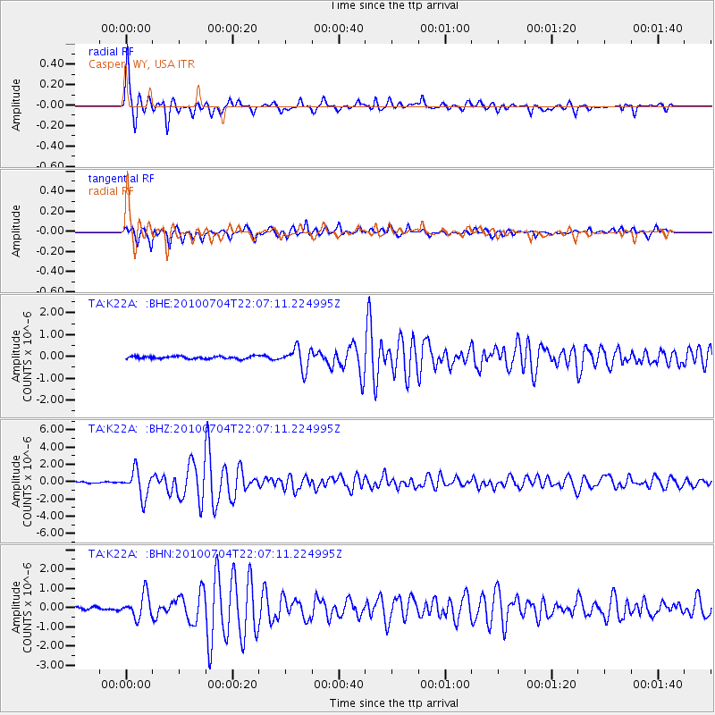
Signal To Noise
| Channel | StoN | STA | LTA |
| TA:K22A: :BHZ:20100704T22:07:11.224995Z | 22.697508 | 1.5509403E-6 | 6.833086E-8 |
| TA:K22A: :BHN:20100704T22:07:11.224995Z | 6.1532507 | 6.1932366E-7 | 1.0064983E-7 |
| TA:K22A: :BHE:20100704T22:07:11.224995Z | 8.5699415 | 4.992398E-7 | 5.825475E-8 |
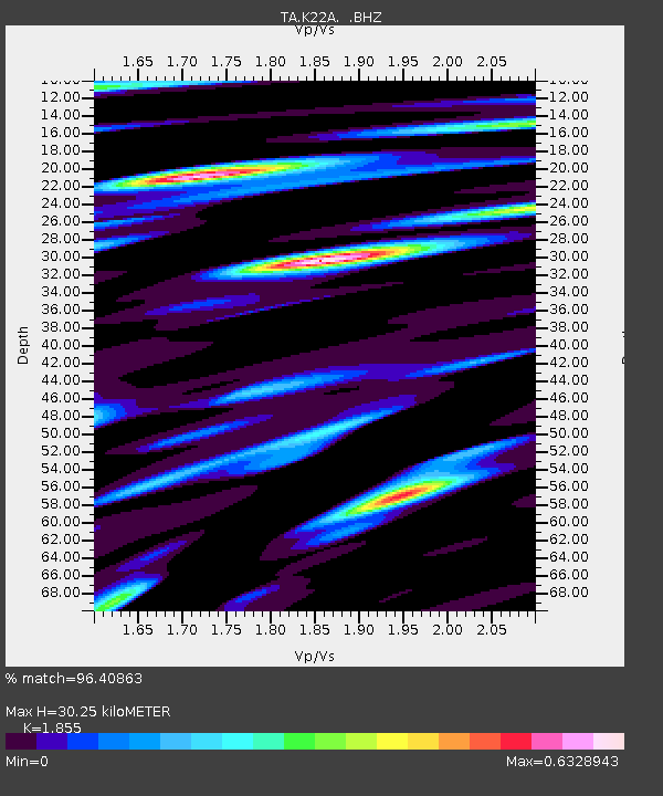
| Arrivals | |
| Ps | 4.3 SECOND |
| PpPs | 14 SECOND |
| PsPs/PpSs | 18 SECOND |

