
G21A Lodge Grass, MT, USA - Earthquake Result Viewer
| ||||||||||||||||||
| ||||||||||||||||||
| ||||||||||||||||||
|
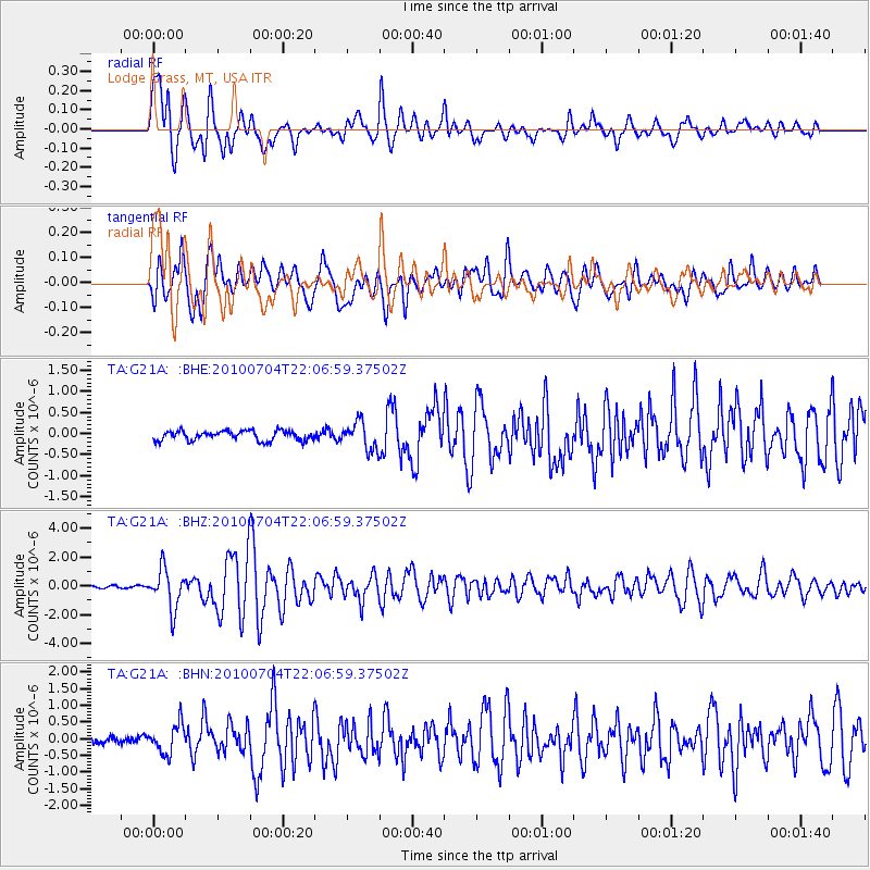
Signal To Noise
| Channel | StoN | STA | LTA |
| TA:G21A: :BHZ:20100704T22:06:59.37502Z | 17.76862 | 1.3800578E-6 | 7.766827E-8 |
| TA:G21A: :BHN:20100704T22:06:59.37502Z | 4.439482 | 4.326965E-7 | 9.746553E-8 |
| TA:G21A: :BHE:20100704T22:06:59.37502Z | 2.806956 | 3.2506654E-7 | 1.15807495E-7 |
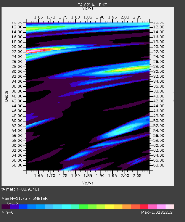
| Arrivals | |
| Ps | 2.2 SECOND |
| PpPs | 8.9 SECOND |
| PsPs/PpSs | 11 SECOND |

