
J19A Crowheart, WY, USA - Earthquake Result Viewer
| ||||||||||||||||||
| ||||||||||||||||||
| ||||||||||||||||||
|
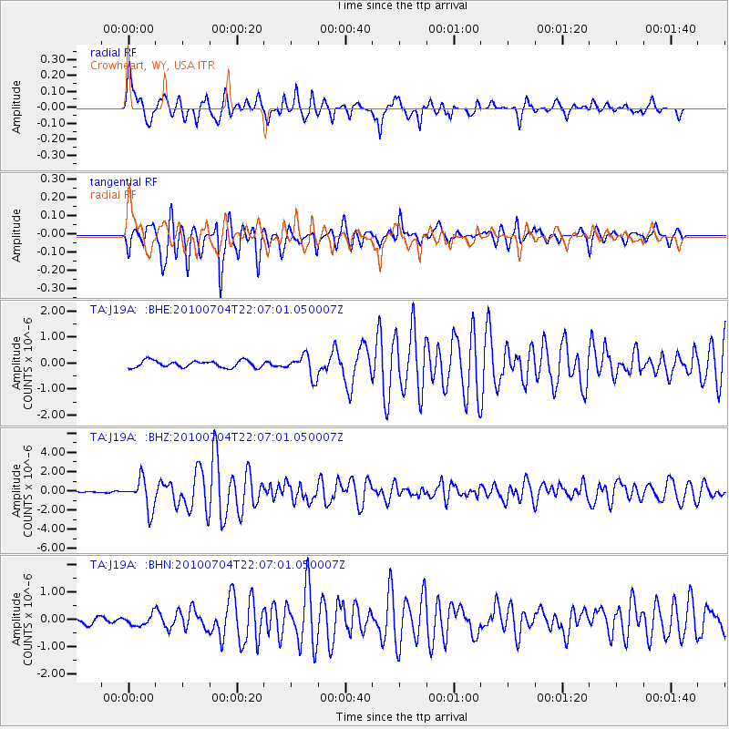
Signal To Noise
| Channel | StoN | STA | LTA |
| TA:J19A: :BHZ:20100704T22:07:01.050007Z | 15.758954 | 1.6093752E-6 | 1.02124496E-7 |
| TA:J19A: :BHN:20100704T22:07:01.050007Z | 2.240645 | 2.0750944E-7 | 9.261149E-8 |
| TA:J19A: :BHE:20100704T22:07:01.050007Z | 3.2989101 | 4.289668E-7 | 1.3003289E-7 |
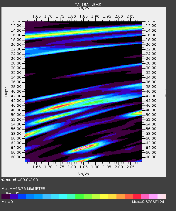
| Arrivals | |
| Ps | 9.0 SECOND |
| PpPs | 29 SECOND |
| PsPs/PpSs | 38 SECOND |

