D22A Cohagen, MT, USA - Earthquake Result Viewer
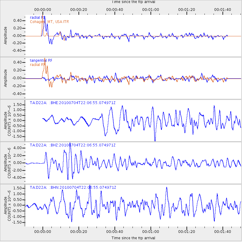
Earthquake location: Near East Coast Of Honshu, Japan
Earthquake latitude/longitude: 39.7/142.4
Earthquake time(UTC): 2010/07/04 (185) 21:55:51 GMT
Earthquake Depth: 27 km
Earthquake Magnitude: 6.4 MB, 6.1 MS, 6.3 MW, 6.2 MW
Earthquake Catalog/Contributor: WHDF/NEIC
Network: TA USArray Transportable Network (new EarthScope stations)
Station: D22A Cohagen, MT, USA
Lat/Lon: 47.15 N/106.18 W
Elevation: 791 m
Distance: 74.2 deg
Az: 41.316 deg
Baz: 311.728 deg
Ray Param: 0.05246239
Estimated Moho Depth: 21.25 km
Estimated Crust Vp/Vs: 1.75
Assumed Crust Vp: 6.438 km/s
Estimated Crust Vs: 3.689 km/s
Estimated Crust Poisson's Ratio: 0.26
Radial Match: 87.42925 %
Radial Bump: 400
Transverse Match: 69.08386 %
Transverse Bump: 400
SOD ConfigId: 319893
Insert Time: 2011-01-05 00:13:21.012 +0000
GWidth: 2.5
Max Bumps: 400
Tol: 0.001

Signal To Noise

ChannelStoNSTALTA
TA:D22A: :BHZ:20100704T22:06:55.074971Z19.1755641.7791374E-69.278149E-8
TA:D22A: :BHN:20100704T22:06:55.074971Z2.15021473.2472713E-71.5102079E-7
TA:D22A: :BHE:20100704T22:06:55.074971Z2.43807175.283208E-72.1669617E-7
Arrivals
Ps2.5 SECOND
PpPs8.8 SECOND
PsPs/PpSs11 SECOND