SFIN Lafayette, IN, USA - Earthquake Result Viewer
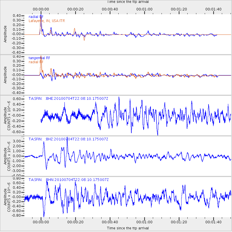
Earthquake location: Near East Coast Of Honshu, Japan
Earthquake latitude/longitude: 39.7/142.4
Earthquake time(UTC): 2010/07/04 (185) 21:55:51 GMT
Earthquake Depth: 27 km
Earthquake Magnitude: 6.4 MB, 6.1 MS, 6.3 MW, 6.2 MW
Earthquake Catalog/Contributor: WHDF/NEIC
Network: TA USArray Transportable Network (new EarthScope stations)
Station: SFIN Lafayette, IN, USA
Lat/Lon: 40.38 N/87.10 W
Elevation: 165 m
Distance: 88.4 deg
Az: 35.508 deg
Baz: 324.084 deg
Ray Param: 0.042565882
Estimated Moho Depth: 35.75 km
Estimated Crust Vp/Vs: 2.06
Assumed Crust Vp: 6.498 km/s
Estimated Crust Vs: 3.154 km/s
Estimated Crust Poisson's Ratio: 0.35
Radial Match: 91.46313 %
Radial Bump: 361
Transverse Match: 79.40505 %
Transverse Bump: 376
SOD ConfigId: 319893
Insert Time: 2011-01-05 00:14:49.382 +0000
GWidth: 2.5
Max Bumps: 400
Tol: 0.001

Signal To Noise

ChannelStoNSTALTA
TA:SFIN: :BHZ:20100704T22:08:10.175007Z15.14071751.3129377E-68.671569E-8
TA:SFIN: :BHN:20100704T22:08:10.175007Z5.28726053.8797666E-77.3379525E-8
TA:SFIN: :BHE:20100704T22:08:10.175007Z2.28148152.7834764E-71.2200303E-7
Arrivals
Ps5.9 SECOND
PpPs17 SECOND
PsPs/PpSs22 SECOND