TUL1 Leonard, OK, USA - Earthquake Result Viewer
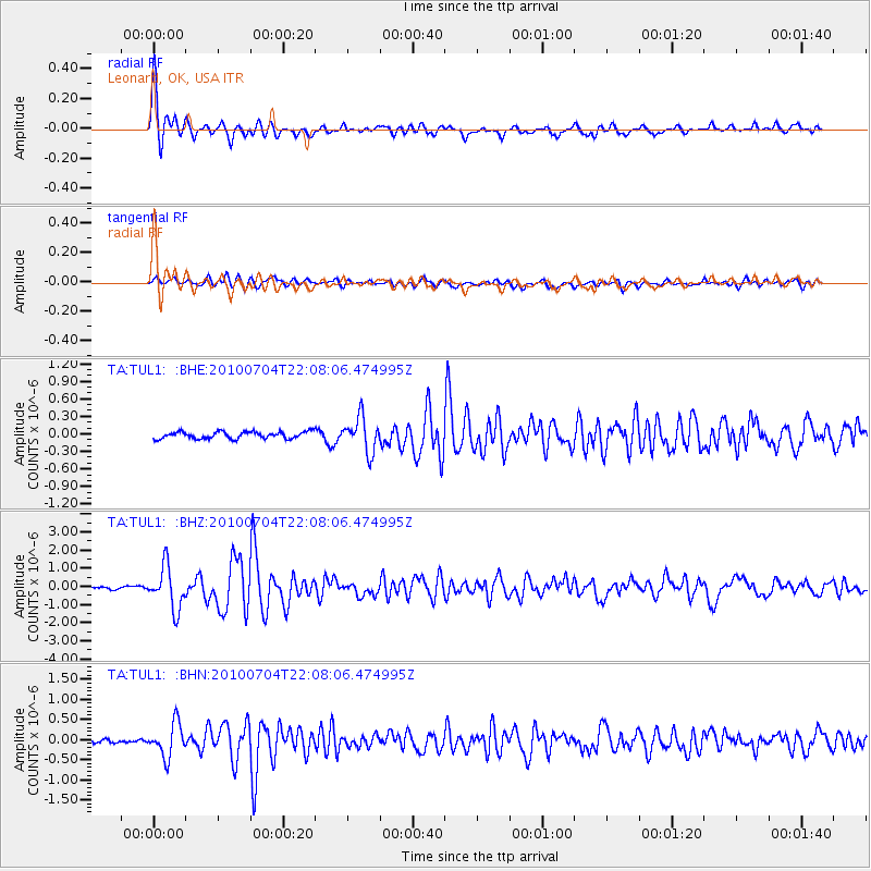
Earthquake location: Near East Coast Of Honshu, Japan
Earthquake latitude/longitude: 39.7/142.4
Earthquake time(UTC): 2010/07/04 (185) 21:55:51 GMT
Earthquake Depth: 27 km
Earthquake Magnitude: 6.4 MB, 6.1 MS, 6.3 MW, 6.2 MW
Earthquake Catalog/Contributor: WHDF/NEIC
Network: TA USArray Transportable Network (new EarthScope stations)
Station: TUL1 Leonard, OK, USA
Lat/Lon: 35.91 N/95.79 W
Elevation: 256 m
Distance: 87.6 deg
Az: 43.649 deg
Baz: 319.005 deg
Ray Param: 0.043144386
Estimated Moho Depth: 25.0 km
Estimated Crust Vp/Vs: 1.60
Assumed Crust Vp: 6.498 km/s
Estimated Crust Vs: 4.061 km/s
Estimated Crust Poisson's Ratio: 0.18
Radial Match: 93.97205 %
Radial Bump: 388
Transverse Match: 73.200935 %
Transverse Bump: 400
SOD ConfigId: 319893
Insert Time: 2011-01-05 00:15:01.566 +0000
GWidth: 2.5
Max Bumps: 400
Tol: 0.001

Signal To Noise

ChannelStoNSTALTA
TA:TUL1: :BHZ:20100704T22:08:06.474995Z17.1763651.1547644E-66.722985E-8
TA:TUL1: :BHN:20100704T22:08:06.474995Z6.7912074.1211484E-76.06836E-8
TA:TUL1: :BHE:20100704T22:08:06.474995Z4.93733452.9163502E-75.9067297E-8
Arrivals
Ps2.4 SECOND
PpPs9.8 SECOND
PsPs/PpSs12 SECOND