
E23A Ismay, MT, USA - Earthquake Result Viewer
| ||||||||||||||||||
| ||||||||||||||||||
| ||||||||||||||||||
|
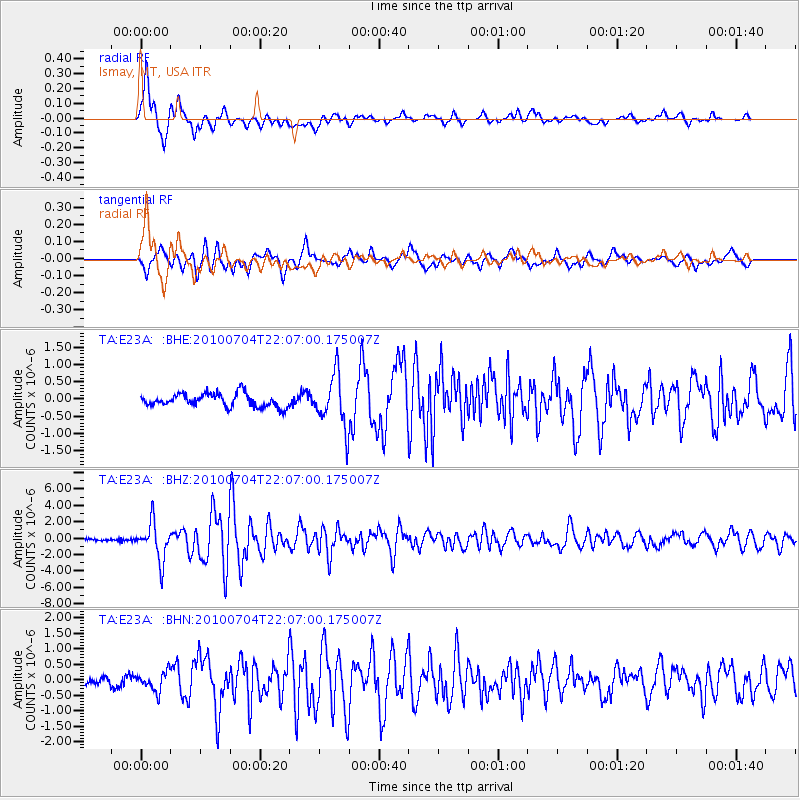
Signal To Noise
| Channel | StoN | STA | LTA |
| TA:E23A: :BHZ:20100704T22:07:00.175007Z | 18.405931 | 2.2765023E-6 | 1.236831E-7 |
| TA:E23A: :BHN:20100704T22:07:00.175007Z | 1.920494 | 3.059961E-7 | 1.5933198E-7 |
| TA:E23A: :BHE:20100704T22:07:00.175007Z | 3.9572423 | 7.5281645E-7 | 1.9023764E-7 |
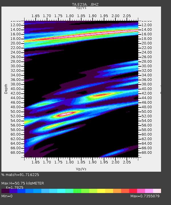
| Arrivals | |
| Ps | 6.4 SECOND |
| PpPs | 21 SECOND |
| PsPs/PpSs | 28 SECOND |

