F22A Rosebud, MT, USA - Earthquake Result Viewer
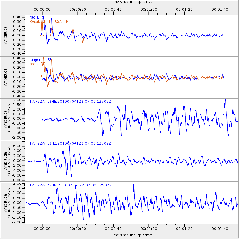
Earthquake location: Near East Coast Of Honshu, Japan
Earthquake latitude/longitude: 39.7/142.4
Earthquake time(UTC): 2010/07/04 (185) 21:55:51 GMT
Earthquake Depth: 27 km
Earthquake Magnitude: 6.4 MB, 6.1 MS, 6.3 MW, 6.2 MW
Earthquake Catalog/Contributor: WHDF/NEIC
Network: TA USArray Transportable Network (new EarthScope stations)
Station: F22A Rosebud, MT, USA
Lat/Lon: 45.78 N/106.26 W
Elevation: 882 m
Distance: 75.1 deg
Az: 42.412 deg
Baz: 311.963 deg
Ray Param: 0.05187904
Estimated Moho Depth: 11.5 km
Estimated Crust Vp/Vs: 1.93
Assumed Crust Vp: 6.178 km/s
Estimated Crust Vs: 3.205 km/s
Estimated Crust Poisson's Ratio: 0.32
Radial Match: 94.13736 %
Radial Bump: 400
Transverse Match: 81.934326 %
Transverse Bump: 400
SOD ConfigId: 319893
Insert Time: 2011-01-05 00:16:03.373 +0000
GWidth: 2.5
Max Bumps: 400
Tol: 0.001

Signal To Noise

ChannelStoNSTALTA
TA:F22A: :BHZ:20100704T22:07:00.12502Z18.7863121.9771614E-61.0524479E-7
TA:F22A: :BHN:20100704T22:07:00.12502Z2.94588833.4955156E-71.1865745E-7
TA:F22A: :BHE:20100704T22:07:00.12502Z6.12641247.4526406E-71.2164772E-7
Arrivals
Ps1.8 SECOND
PpPs5.3 SECOND
PsPs/PpSs7.1 SECOND