G22A Birney, MT, USA - Earthquake Result Viewer
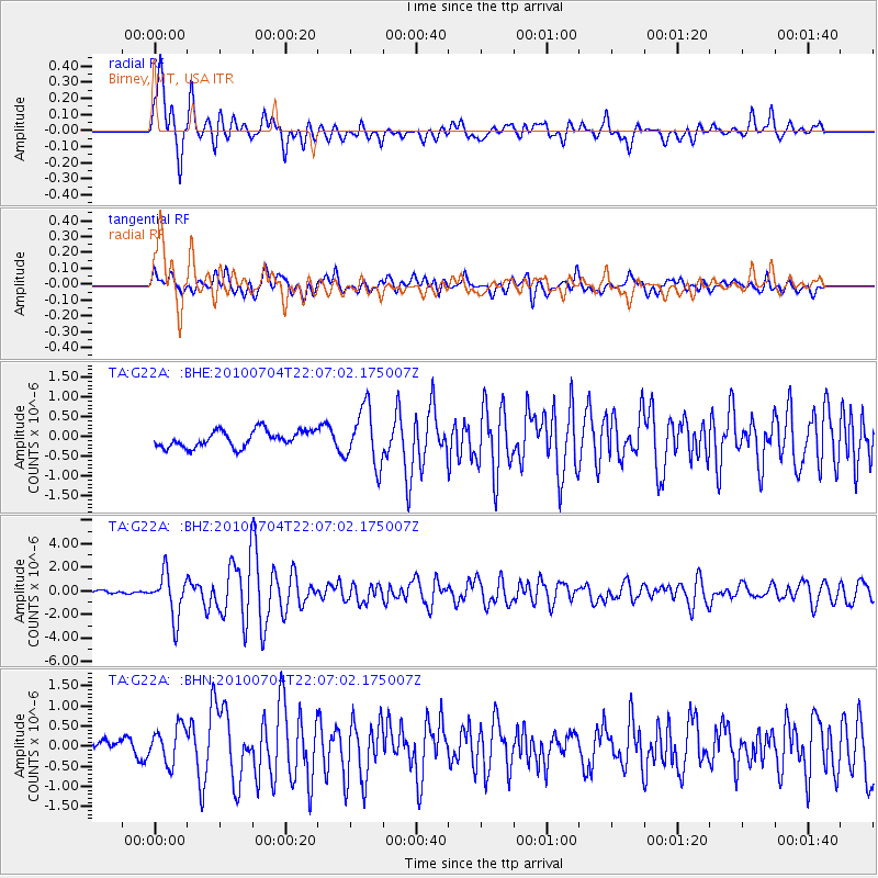
Earthquake location: Near East Coast Of Honshu, Japan
Earthquake latitude/longitude: 39.7/142.4
Earthquake time(UTC): 2010/07/04 (185) 21:55:51 GMT
Earthquake Depth: 27 km
Earthquake Magnitude: 6.4 MB, 6.1 MS, 6.3 MW, 6.2 MW
Earthquake Catalog/Contributor: WHDF/NEIC
Network: TA USArray Transportable Network (new EarthScope stations)
Station: G22A Birney, MT, USA
Lat/Lon: 45.22 N/106.29 W
Elevation: 1203 m
Distance: 75.4 deg
Az: 42.86 deg
Baz: 312.052 deg
Ray Param: 0.05164295
Estimated Moho Depth: 36.5 km
Estimated Crust Vp/Vs: 1.96
Assumed Crust Vp: 6.178 km/s
Estimated Crust Vs: 3.156 km/s
Estimated Crust Poisson's Ratio: 0.32
Radial Match: 87.18605 %
Radial Bump: 400
Transverse Match: 67.38599 %
Transverse Bump: 400
SOD ConfigId: 319893
Insert Time: 2011-01-05 00:16:52.776 +0000
GWidth: 2.5
Max Bumps: 400
Tol: 0.001

Signal To Noise

ChannelStoNSTALTA
TA:G22A: :BHZ:20100704T22:07:02.175007Z13.4268151.8484445E-61.3766812E-7
TA:G22A: :BHN:20100704T22:07:02.175007Z3.01684454.6987995E-71.5575212E-7
TA:G22A: :BHE:20100704T22:07:02.175007Z3.4598057.1575573E-72.0687747E-7
Arrivals
Ps5.8 SECOND
PpPs17 SECOND
PsPs/PpSs23 SECOND