X28A Dimmitt, TX, USA - Earthquake Result Viewer
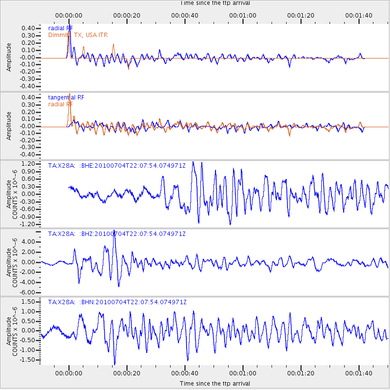
Earthquake location: Near East Coast Of Honshu, Japan
Earthquake latitude/longitude: 39.7/142.4
Earthquake time(UTC): 2010/07/04 (185) 21:55:51 GMT
Earthquake Depth: 27 km
Earthquake Magnitude: 6.4 MB, 6.1 MS, 6.3 MW, 6.2 MW
Earthquake Catalog/Contributor: WHDF/NEIC
Network: TA USArray Transportable Network (new EarthScope stations)
Station: X28A Dimmitt, TX, USA
Lat/Lon: 34.52 N/102.20 W
Elevation: 1160 m
Distance: 85.1 deg
Az: 48.453 deg
Baz: 315.629 deg
Ray Param: 0.04496948
Estimated Moho Depth: 45.5 km
Estimated Crust Vp/Vs: 1.65
Assumed Crust Vp: 6.242 km/s
Estimated Crust Vs: 3.789 km/s
Estimated Crust Poisson's Ratio: 0.21
Radial Match: 90.09052 %
Radial Bump: 400
Transverse Match: 85.28107 %
Transverse Bump: 400
SOD ConfigId: 319893
Insert Time: 2011-01-05 00:18:44.741 +0000
GWidth: 2.5
Max Bumps: 400
Tol: 0.001

Signal To Noise

ChannelStoNSTALTA
TA:X28A: :BHZ:20100704T22:07:54.074971Z7.41599041.5043516E-62.0285243E-7
TA:X28A: :BHN:20100704T22:07:54.074971Z3.04495224.5000073E-71.4778581E-7
TA:X28A: :BHE:20100704T22:07:54.074971Z2.4076733.5724898E-71.4837937E-7
Arrivals
Ps4.8 SECOND
PpPs19 SECOND
PsPs/PpSs24 SECOND