You are here: Home > Network List > TA - USArray Transportable Network (new EarthScope stations) Stations List
> Station 430A Baggett Ranch, Ozona, TX, USA > Earthquake Result Viewer
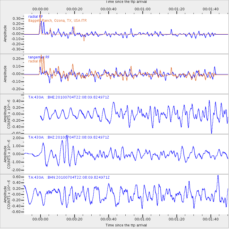
430A Baggett Ranch, Ozona, TX, USA - Earthquake Result Viewer
*The percent match for this event was below the threshold and hence no stack was calculated.
| Earthquake location: |
Near East Coast Of Honshu, Japan |
| Earthquake latitude/longitude: |
39.7/142.4 |
| Earthquake time(UTC): |
2010/07/04 (185) 21:55:51 GMT |
| Earthquake Depth: |
27 km |
| Earthquake Magnitude: |
6.4 MB, 6.1 MS, 6.3 MW, 6.2 MW |
| Earthquake Catalog/Contributor: |
WHDF/NEIC |
|
| Network: |
TA USArray Transportable Network (new EarthScope stations) |
| Station: |
430A Baggett Ranch, Ozona, TX, USA |
| Lat/Lon: |
30.79 N/101.24 W |
| Elevation: |
768 m |
|
| Distance: |
88.3 deg |
| Az: |
50.461 deg |
| Baz: |
316.26 deg |
| Ray Param: |
$rayparam |
*The percent match for this event was below the threshold and hence was not used in the summary stack. |
|
| Radial Match: |
72.8038 % |
| Radial Bump: |
400 |
| Transverse Match: |
68.52878 % |
| Transverse Bump: |
400 |
| SOD ConfigId: |
319893 |
| Insert Time: |
2011-01-05 00:19:59.195 +0000 |
| GWidth: |
2.5 |
| Max Bumps: |
400 |
| Tol: |
0.001 |
|
Signal To Noise
| Channel | StoN | STA | LTA |
| TA:430A: :BHZ:20100704T22:08:09.824971Z | 4.828255 | 9.216064E-7 | 1.9087773E-7 |
| TA:430A: :BHN:20100704T22:08:09.824971Z | 0.672747 | 1.69409E-7 | 2.518168E-7 |
| TA:430A: :BHE:20100704T22:08:09.824971Z | 1.0132014 | 1.0992936E-7 | 1.0849705E-7 |
| Arrivals |
| Ps | |
| PpPs | |
| PsPs/PpSs | |


