
231A Bronte, TX, USA - Earthquake Result Viewer
| ||||||||||||||||||
| ||||||||||||||||||
| ||||||||||||||||||
|
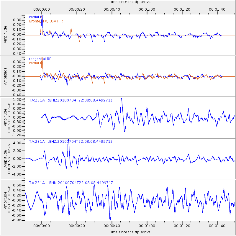
Signal To Noise
| Channel | StoN | STA | LTA |
| TA:231A: :BHZ:20100704T22:08:08.449971Z | 7.604342 | 1.134431E-6 | 1.4918201E-7 |
| TA:231A: :BHN:20100704T22:08:08.449971Z | 1.7217717 | 2.6115745E-7 | 1.5167949E-7 |
| TA:231A: :BHE:20100704T22:08:08.449971Z | 2.7572055 | 3.0953174E-7 | 1.1226285E-7 |
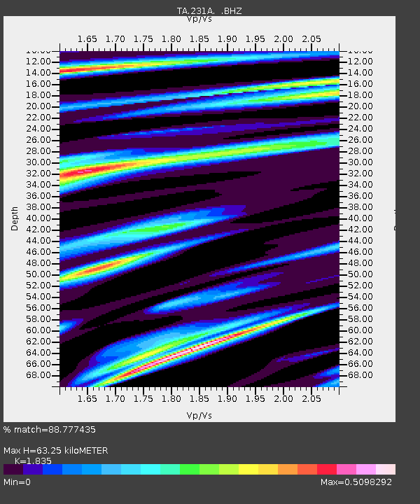
| Arrivals | |
| Ps | 8.5 SECOND |
| PpPs | 28 SECOND |
| PsPs/PpSs | 36 SECOND |

