331A San Angelo, TX, USA - Earthquake Result Viewer
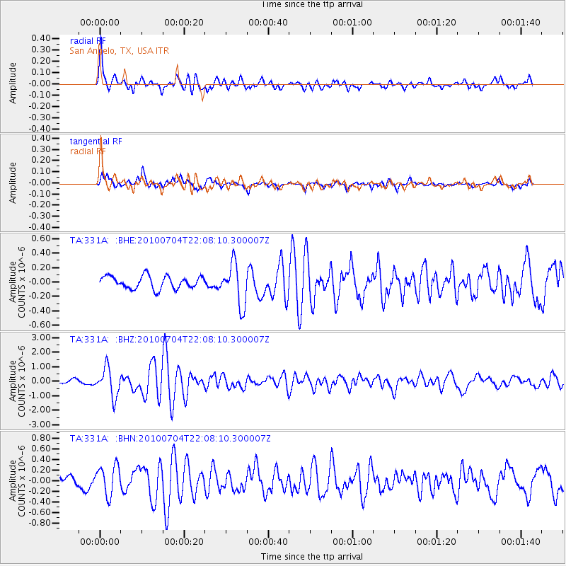
Earthquake location: Near East Coast Of Honshu, Japan
Earthquake latitude/longitude: 39.7/142.4
Earthquake time(UTC): 2010/07/04 (185) 21:55:51 GMT
Earthquake Depth: 27 km
Earthquake Magnitude: 6.4 MB, 6.1 MS, 6.3 MW, 6.2 MW
Earthquake Catalog/Contributor: WHDF/NEIC
Network: TA USArray Transportable Network (new EarthScope stations)
Station: 331A San Angelo, TX, USA
Lat/Lon: 31.31 N/100.43 W
Elevation: 615 m
Distance: 88.4 deg
Az: 49.599 deg
Baz: 316.651 deg
Ray Param: 0.04254786
Estimated Moho Depth: 51.5 km
Estimated Crust Vp/Vs: 1.68
Assumed Crust Vp: 6.38 km/s
Estimated Crust Vs: 3.804 km/s
Estimated Crust Poisson's Ratio: 0.22
Radial Match: 88.659294 %
Radial Bump: 400
Transverse Match: 78.58089 %
Transverse Bump: 400
SOD ConfigId: 319893
Insert Time: 2011-01-05 00:20:59.758 +0000
GWidth: 2.5
Max Bumps: 400
Tol: 0.001

Signal To Noise

ChannelStoNSTALTA
TA:331A: :BHZ:20100704T22:08:10.300007Z6.258631.0141262E-61.6203644E-7
TA:331A: :BHN:20100704T22:08:10.300007Z2.2190612.8207214E-71.271133E-7
TA:331A: :BHE:20100704T22:08:10.300007Z3.4113622.981604E-78.740216E-8
Arrivals
Ps5.6 SECOND
PpPs21 SECOND
PsPs/PpSs27 SECOND