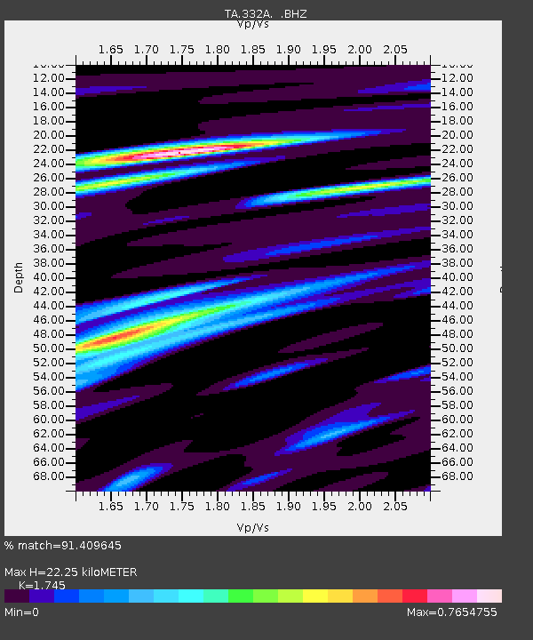
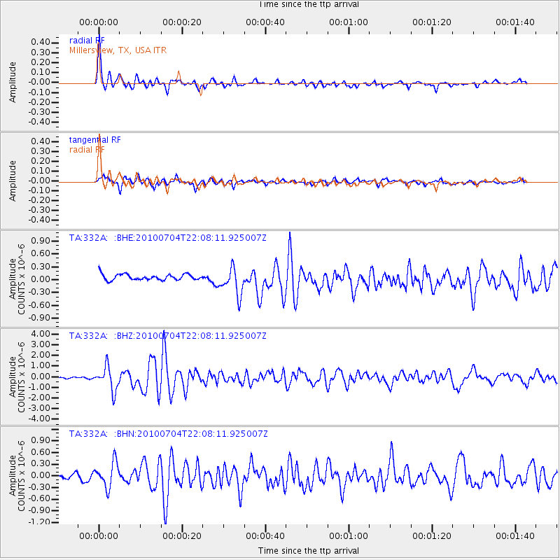
332A Millersview, TX, USA - Earthquake Result Viewer

Earthquake location: Near East Coast Of Honshu, Japan
Earthquake latitude/longitude: 39.7/142.4
Earthquake time(UTC): 2010/07/04 (185) 21:55:51 GMT
Earthquake Depth: 27 km
Earthquake Magnitude: 6.4 MB, 6.1 MS, 6.3 MW, 6.2 MW
Earthquake Catalog/Contributor: WHDF/NEIC
Network: TA USArray Transportable Network (new EarthScope stations)
Station: 332A Millersview, TX, USA
Lat/Lon: 31.38 N/99.74 W
Elevation: 513 m
Distance: 88.8 deg
Az: 49.121 deg
Baz: 316.994 deg
Ray Param: 0.042289287
Estimated Moho Depth: 22.25 km
Estimated Crust Vp/Vs: 1.75
Assumed Crust Vp: 6.498 km/s
Estimated Crust Vs: 3.724 km/s
Estimated Crust Poisson's Ratio: 0.26
Radial Match: 91.409645 %
Radial Bump: 400
Transverse Match: 83.19022 %
Transverse Bump: 400
SOD ConfigId: 319893
Insert Time: 2011-01-05 00:21:00.306 +0000
GWidth: 2.5
Max Bumps: 400
Tol: 0.001

Signal To Noise

ChannelStoNSTALTA
TA:332A: :BHZ:20100704T22:08:11.925007Z20.2377411.1485439E-65.6752572E-8
TA:332A: :BHN:20100704T22:08:11.925007Z3.44315963.3432485E-79.709827E-8
TA:332A: :BHE:20100704T22:08:11.925007Z4.85206033.291007E-76.7827E-8
Arrivals
Ps2.6 SECOND
PpPs9.2 SECOND
PsPs/PpSs12 SECOND