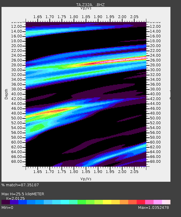
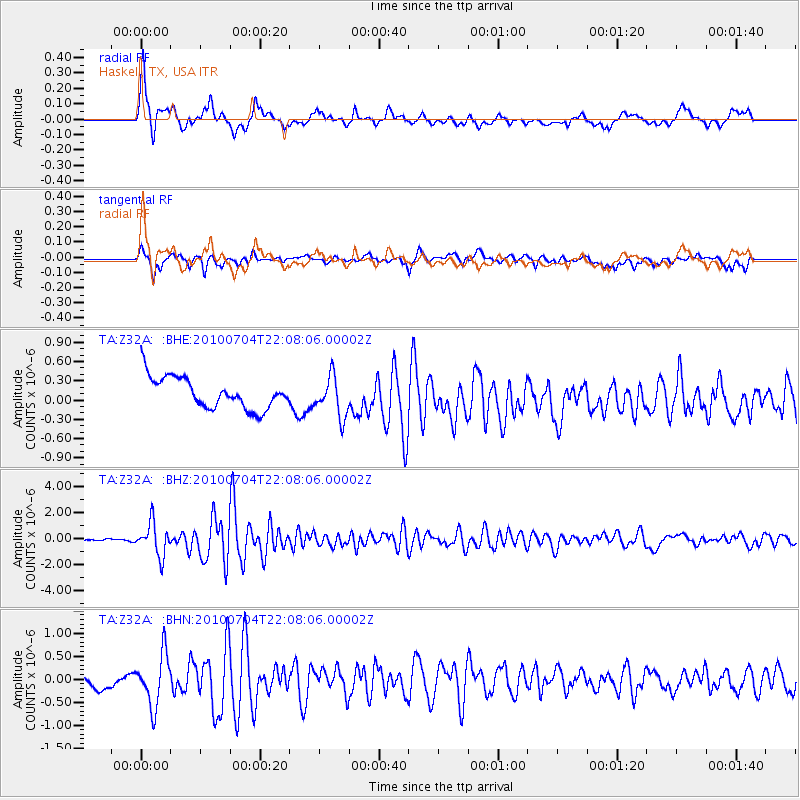
Z32A Haskell, TX, USA - Earthquake Result Viewer

Earthquake location: Near East Coast Of Honshu, Japan
Earthquake latitude/longitude: 39.7/142.4
Earthquake time(UTC): 2010/07/04 (185) 21:55:51 GMT
Earthquake Depth: 27 km
Earthquake Magnitude: 6.4 MB, 6.1 MS, 6.3 MW, 6.2 MW
Earthquake Catalog/Contributor: WHDF/NEIC
Network: TA USArray Transportable Network (new EarthScope stations)
Station: Z32A Haskell, TX, USA
Lat/Lon: 33.31 N/99.48 W
Elevation: 427 m
Distance: 87.5 deg
Az: 47.649 deg
Baz: 317.087 deg
Ray Param: 0.04322008
Estimated Moho Depth: 25.5 km
Estimated Crust Vp/Vs: 2.01
Assumed Crust Vp: 6.426 km/s
Estimated Crust Vs: 3.193 km/s
Estimated Crust Poisson's Ratio: 0.34
Radial Match: 87.35187 %
Radial Bump: 400
Transverse Match: 55.38253 %
Transverse Bump: 400
SOD ConfigId: 319893
Insert Time: 2011-01-05 00:21:13.119 +0000
GWidth: 2.5
Max Bumps: 400
Tol: 0.001

Signal To Noise

ChannelStoNSTALTA
TA:Z32A: :BHZ:20100704T22:08:06.00002Z15.3438881.2449217E-68.1134694E-8
TA:Z32A: :BHN:20100704T22:08:06.00002Z2.1249345.751193E-72.706528E-7
TA:Z32A: :BHE:20100704T22:08:06.00002Z1.30097933.1429371E-72.4158243E-7
Arrivals
Ps4.1 SECOND
PpPs12 SECOND
PsPs/PpSs16 SECOND