
S29A Ulysses, KS, USA - Earthquake Result Viewer
| ||||||||||||||||||
| ||||||||||||||||||
| ||||||||||||||||||
|
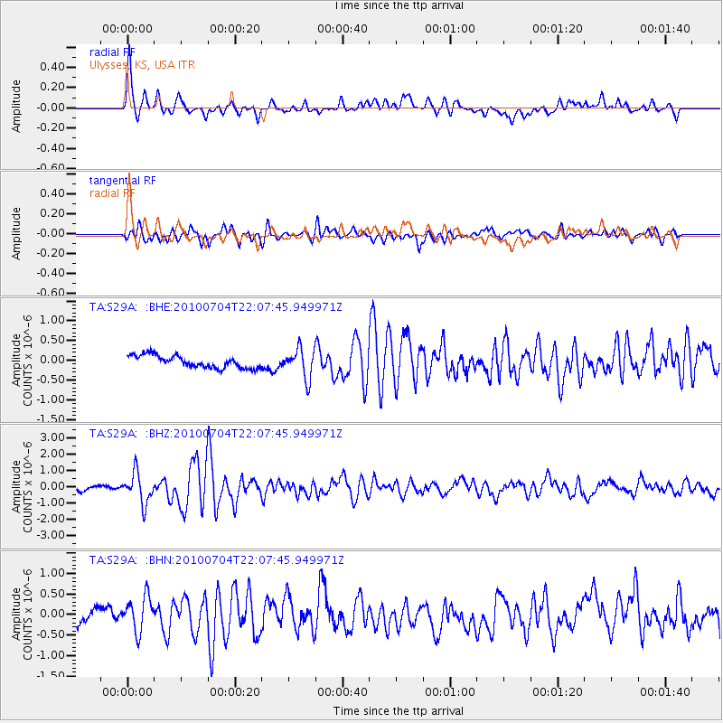
Signal To Noise
| Channel | StoN | STA | LTA |
| TA:S29A: :BHZ:20100704T22:07:45.949971Z | 7.03051 | 9.4229824E-7 | 1.3402986E-7 |
| TA:S29A: :BHN:20100704T22:07:45.949971Z | 2.489965 | 4.4653652E-7 | 1.7933446E-7 |
| TA:S29A: :BHE:20100704T22:07:45.949971Z | 2.4158454 | 3.7389987E-7 | 1.5476978E-7 |
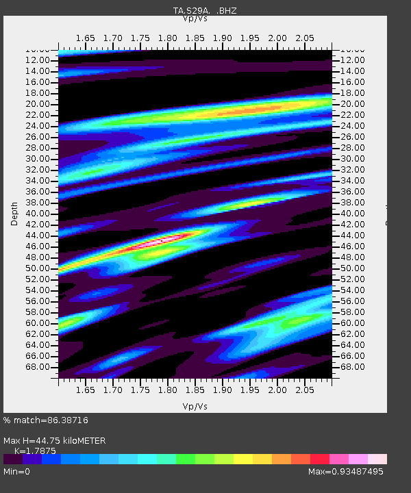
| Arrivals | |
| Ps | 5.6 SECOND |
| PpPs | 19 SECOND |
| PsPs/PpSs | 24 SECOND |

