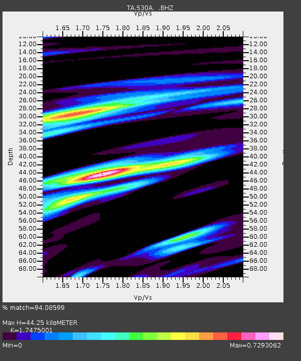
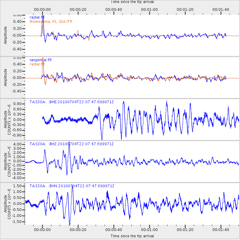
S30A Montezuma, KS, USA - Earthquake Result Viewer

Earthquake location: Near East Coast Of Honshu, Japan
Earthquake latitude/longitude: 39.7/142.4
Earthquake time(UTC): 2010/07/04 (185) 21:55:51 GMT
Earthquake Depth: 27 km
Earthquake Magnitude: 6.4 MB, 6.1 MS, 6.3 MW, 6.2 MW
Earthquake Catalog/Contributor: WHDF/NEIC
Network: TA USArray Transportable Network (new EarthScope stations)
Station: S30A Montezuma, KS, USA
Lat/Lon: 37.64 N/100.46 W
Elevation: 853 m
Distance: 83.8 deg
Az: 45.264 deg
Baz: 316.338 deg
Ray Param: 0.045867004
Estimated Moho Depth: 44.25 km
Estimated Crust Vp/Vs: 1.75
Assumed Crust Vp: 6.483 km/s
Estimated Crust Vs: 3.71 km/s
Estimated Crust Poisson's Ratio: 0.26
Radial Match: 94.08599 %
Radial Bump: 400
Transverse Match: 88.283714 %
Transverse Bump: 400
SOD ConfigId: 319893
Insert Time: 2011-01-05 00:23:17.568 +0000
GWidth: 2.5
Max Bumps: 400
Tol: 0.001

Signal To Noise

ChannelStoNSTALTA
TA:S30A: :BHZ:20100704T22:07:47.699971Z9.88715651.2159843E-61.2298625E-7
TA:S30A: :BHN:20100704T22:07:47.699971Z2.88164234.799544E-71.6655585E-7
TA:S30A: :BHE:20100704T22:07:47.699971Z4.68220144.730898E-71.01040044E-7
Arrivals
Ps5.2 SECOND
PpPs18 SECOND
PsPs/PpSs24 SECOND