You are here: Home > Network List > US - United States National Seismic Network Stations List
> Station AMTX Amarillo, Texas, USA > Earthquake Result Viewer
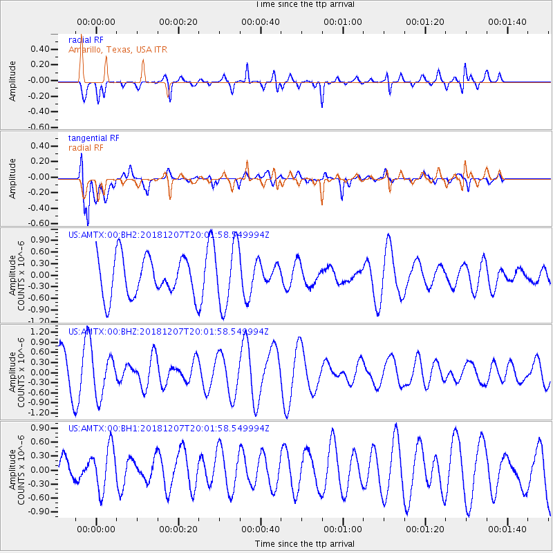
AMTX Amarillo, Texas, USA - Earthquake Result Viewer
*The percent match for this event was below the threshold and hence no stack was calculated.
| Earthquake location: |
Southern Alaska |
| Earthquake latitude/longitude: |
61.3/-150.0 |
| Earthquake time(UTC): |
2018/12/07 (341) 19:54:54 GMT |
| Earthquake Depth: |
29 km |
| Earthquake Magnitude: |
3.5 ML |
| Earthquake Catalog/Contributor: |
NEIC PDE/ak |
|
| Network: |
US United States National Seismic Network |
| Station: |
AMTX Amarillo, Texas, USA |
| Lat/Lon: |
34.53 N/101.41 W |
| Elevation: |
1010 m |
|
| Distance: |
40.7 deg |
| Az: |
108.405 deg |
| Baz: |
326.332 deg |
| Ray Param: |
$rayparam |
*The percent match for this event was below the threshold and hence was not used in the summary stack. |
|
| Radial Match: |
50.284348 % |
| Radial Bump: |
358 |
| Transverse Match: |
59.05055 % |
| Transverse Bump: |
400 |
| SOD ConfigId: |
3201911 |
| Insert Time: |
2018-12-21 20:11:50.473 +0000 |
| GWidth: |
2.5 |
| Max Bumps: |
400 |
| Tol: |
0.001 |
|
Signal To Noise
| Channel | StoN | STA | LTA |
| US:AMTX:00:BHZ:20181207T20:01:58.549994Z | 0.97818494 | 5.8627484E-7 | 5.993497E-7 |
| US:AMTX:00:BH1:20181207T20:01:58.549994Z | 1.3727809 | 4.8987937E-7 | 3.568518E-7 |
| US:AMTX:00:BH2:20181207T20:01:58.549994Z | 1.2722334 | 6.796483E-7 | 5.3421667E-7 |
| Arrivals |
| Ps | |
| PpPs | |
| PsPs/PpSs | |


