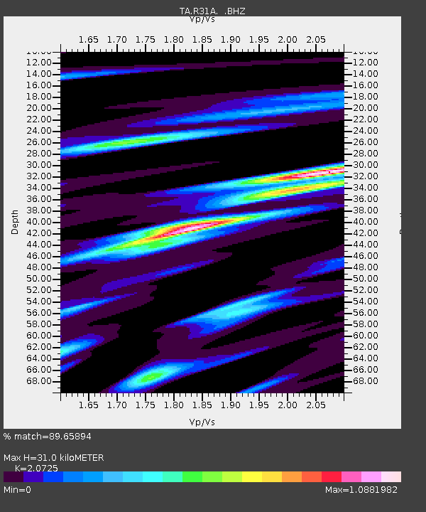
R31A Burdett, KS, USA - Earthquake Result Viewer
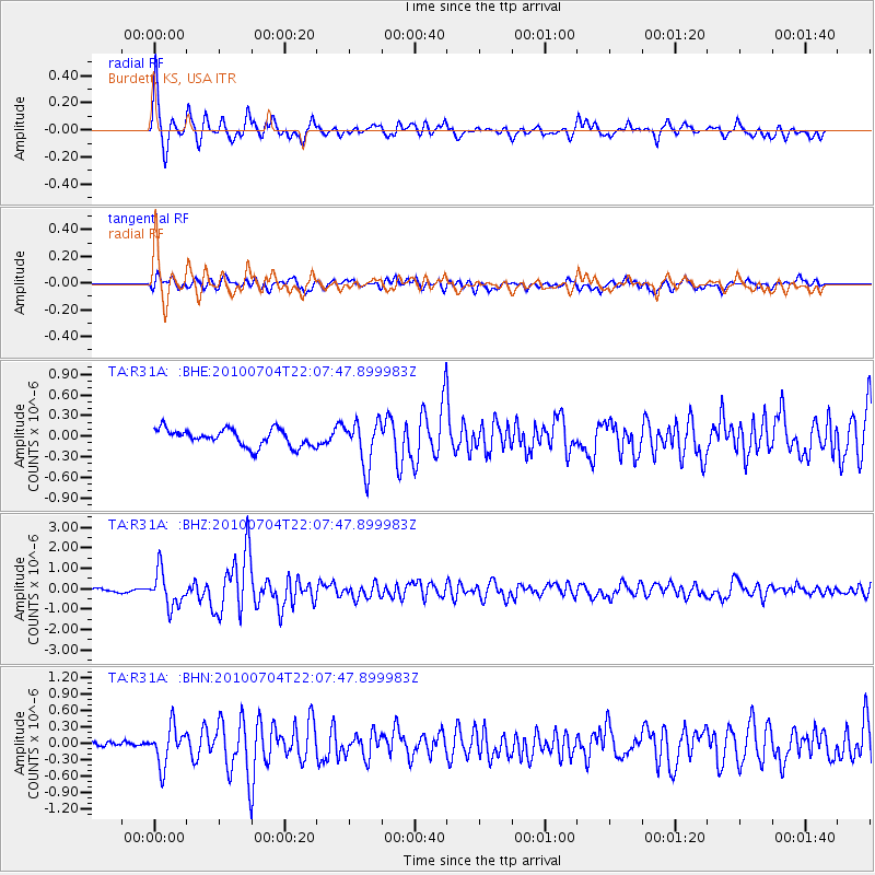
Earthquake location: Near East Coast Of Honshu, Japan
Earthquake latitude/longitude: 39.7/142.4
Earthquake time(UTC): 2010/07/04 (185) 21:55:51 GMT
Earthquake Depth: 27 km
Earthquake Magnitude: 6.4 MB, 6.1 MS, 6.3 MW, 6.2 MW
Earthquake Catalog/Contributor: WHDF/NEIC
Network: TA USArray Transportable Network (new EarthScope stations)
Station: R31A Burdett, KS, USA
Lat/Lon: 38.29 N/99.53 W
Elevation: 667 m
Distance: 83.9 deg
Az: 44.276 deg
Baz: 316.806 deg
Ray Param: 0.045839354
Estimated Moho Depth: 31.0 km
Estimated Crust Vp/Vs: 2.07
Assumed Crust Vp: 6.483 km/s
Estimated Crust Vs: 3.128 km/s
Estimated Crust Poisson's Ratio: 0.35
Radial Match: 89.65894 %
Radial Bump: 400
Transverse Match: 72.29845 %
Transverse Bump: 400
SOD ConfigId: 319893
Insert Time: 2011-01-05 00:24:30.369 +0000
GWidth: 2.5
Max Bumps: 400
Tol: 0.001

Signal To Noise

ChannelStoNSTALTA
TA:R31A: :BHZ:20100704T22:07:47.899983Z9.6845668.4783505E-78.7544976E-8
TA:R31A: :BHN:20100704T22:07:47.899983Z4.09879263.441294E-78.3958724E-8
TA:R31A: :BHE:20100704T22:07:47.899983Z2.67880583.3303186E-71.2432102E-7
Arrivals
Ps5.2 SECOND
PpPs14 SECOND
PsPs/PpSs20 SECOND