
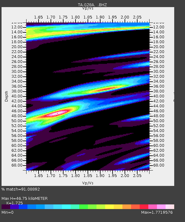
G28A Parade, SD, USA - Earthquake Result Viewer
| ||||||||||||||||||
| ||||||||||||||||||
| ||||||||||||||||||
|
Signal To Noise
| Channel | StoN | STA | LTA |
| TA:G28A: :BHZ:20100704T22:07:18.175007Z | 25.943354 | 2.0744035E-6 | 7.995896E-8 |
| TA:G28A: :BHN:20100704T22:07:18.175007Z | 4.617971 | 9.28794E-7 | 2.01126E-7 |
| TA:G28A: :BHE:20100704T22:07:18.175007Z | 5.321524 | 1.0999307E-6 | 2.0669468E-7 |
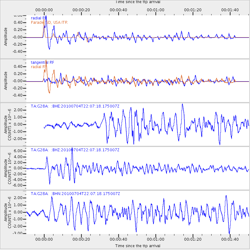
| Arrivals | |
| Ps | 5.4 SECOND |
| PpPs | 19 SECOND |
| PsPs/PpSs | 24 SECOND |

