You are here: Home > Network List > PF - Volcanologic Network of Piton de Fournaise-OVPF Stations List
> Station HIM cratere Himiltrude > Earthquake Result Viewer
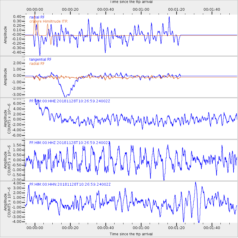
HIM cratere Himiltrude - Earthquake Result Viewer
*The percent match for this event was below the threshold and hence no stack was calculated.
| Earthquake location: |
Myanmar-India Border Region |
| Earthquake latitude/longitude: |
27.2/96.9 |
| Earthquake time(UTC): |
2018/11/28 (332) 10:17:06 GMT |
| Earthquake Depth: |
11 km |
| Earthquake Magnitude: |
5.4 Mww |
| Earthquake Catalog/Contributor: |
NEIC PDE/us |
|
| Network: |
PF Volcanologic Network of Piton de Fournaise-OVPF |
| Station: |
HIM cratere Himiltrude |
| Lat/Lon: |
21.21 S/55.72 E |
| Elevation: |
1958 m |
|
| Distance: |
62.5 deg |
| Az: |
223.859 deg |
| Baz: |
41.406 deg |
| Ray Param: |
$rayparam |
*The percent match for this event was below the threshold and hence was not used in the summary stack. |
|
| Radial Match: |
46.503414 % |
| Radial Bump: |
400 |
| Transverse Match: |
26.213224 % |
| Transverse Bump: |
400 |
| SOD ConfigId: |
3201911 |
| Insert Time: |
2018-12-23 13:17:56.500 +0000 |
| GWidth: |
2.5 |
| Max Bumps: |
400 |
| Tol: |
0.001 |
|
Signal To Noise
| Channel | StoN | STA | LTA |
| PF:HIM:00:HHZ:20181128T10:26:59.24002Z | 0.70483774 | 5.059835E-7 | 7.1787235E-7 |
| PF:HIM:00:HHN:20181128T10:26:59.24002Z | 1.1752173 | 2.6652488E-6 | 2.2678776E-6 |
| PF:HIM:00:HHE:20181128T10:26:59.24002Z | 1.1591945 | 2.7615438E-6 | 2.3822956E-6 |
| Arrivals |
| Ps | |
| PpPs | |
| PsPs/PpSs | |


