H28A Mission Ridge, SD, USA - Earthquake Result Viewer
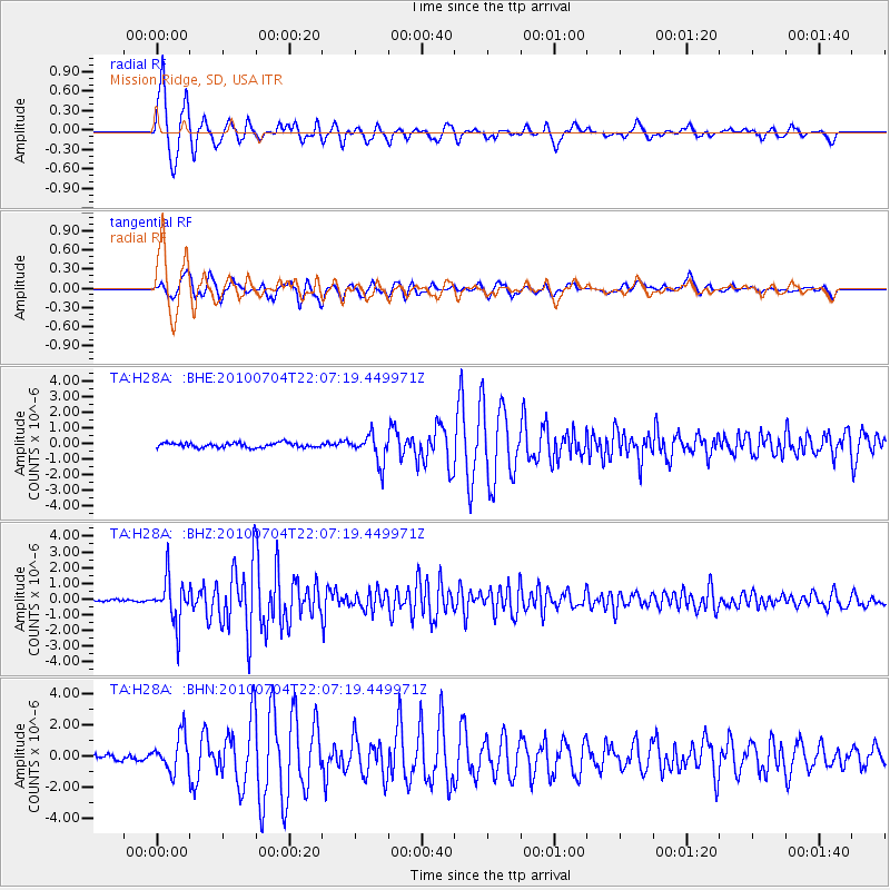
Earthquake location: Near East Coast Of Honshu, Japan
Earthquake latitude/longitude: 39.7/142.4
Earthquake time(UTC): 2010/07/04 (185) 21:55:51 GMT
Earthquake Depth: 27 km
Earthquake Magnitude: 6.4 MB, 6.1 MS, 6.3 MW, 6.2 MW
Earthquake Catalog/Contributor: WHDF/NEIC
Network: TA USArray Transportable Network (new EarthScope stations)
Station: H28A Mission Ridge, SD, USA
Lat/Lon: 44.68 N/101.02 W
Elevation: 642 m
Distance: 78.5 deg
Az: 40.612 deg
Baz: 315.258 deg
Ray Param: 0.049559724
Estimated Moho Depth: 12.0 km
Estimated Crust Vp/Vs: 1.60
Assumed Crust Vp: 6.53 km/s
Estimated Crust Vs: 4.082 km/s
Estimated Crust Poisson's Ratio: 0.18
Radial Match: 97.01118 %
Radial Bump: 357
Transverse Match: 92.14548 %
Transverse Bump: 400
SOD ConfigId: 319893
Insert Time: 2011-01-05 00:26:21.534 +0000
GWidth: 2.5
Max Bumps: 400
Tol: 0.001

Signal To Noise

ChannelStoNSTALTA
TA:H28A: :BHZ:20100704T22:07:19.449971Z27.5546131.4304144E-65.191198E-8
TA:H28A: :BHN:20100704T22:07:19.449971Z7.4318281.1616418E-61.5630631E-7
TA:H28A: :BHE:20100704T22:07:19.449971Z6.04536259.104198E-71.5059805E-7
Arrivals
Ps1.1 SECOND
PpPs4.6 SECOND
PsPs/PpSs5.8 SECOND