I27A Quinn, SD, USA - Earthquake Result Viewer
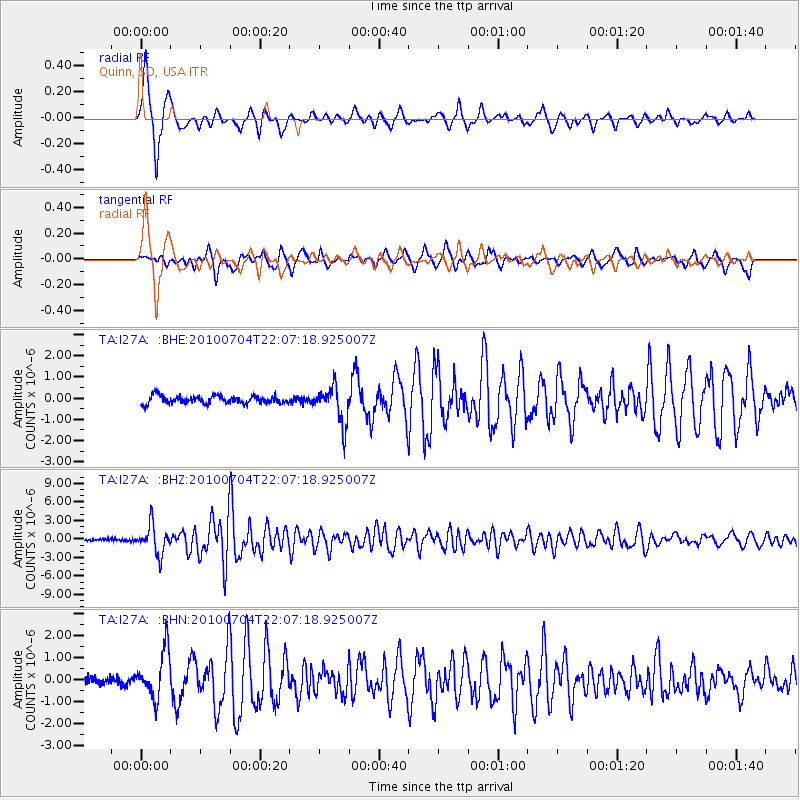
Earthquake location: Near East Coast Of Honshu, Japan
Earthquake latitude/longitude: 39.7/142.4
Earthquake time(UTC): 2010/07/04 (185) 21:55:51 GMT
Earthquake Depth: 27 km
Earthquake Magnitude: 6.4 MB, 6.1 MS, 6.3 MW, 6.2 MW
Earthquake Catalog/Contributor: WHDF/NEIC
Network: TA USArray Transportable Network (new EarthScope stations)
Station: I27A Quinn, SD, USA
Lat/Lon: 44.07 N/102.05 W
Elevation: 867 m
Distance: 78.4 deg
Az: 41.583 deg
Baz: 314.733 deg
Ray Param: 0.049624298
Estimated Moho Depth: 45.0 km
Estimated Crust Vp/Vs: 1.66
Assumed Crust Vp: 6.242 km/s
Estimated Crust Vs: 3.749 km/s
Estimated Crust Poisson's Ratio: 0.22
Radial Match: 94.683136 %
Radial Bump: 332
Transverse Match: 87.09597 %
Transverse Bump: 400
SOD ConfigId: 319893
Insert Time: 2011-01-05 00:26:32.707 +0000
GWidth: 2.5
Max Bumps: 400
Tol: 0.001

Signal To Noise

ChannelStoNSTALTA
TA:I27A: :BHZ:20100704T22:07:18.925007Z16.1248742.3022585E-61.4277684E-7
TA:I27A: :BHN:20100704T22:07:18.925007Z6.5834591.0573913E-61.6061334E-7
TA:I27A: :BHE:20100704T22:07:18.925007Z4.73291448.689716E-71.836018E-7
Arrivals
Ps4.9 SECOND
PpPs19 SECOND
PsPs/PpSs24 SECOND