G25A Newell, SD, USA - Earthquake Result Viewer
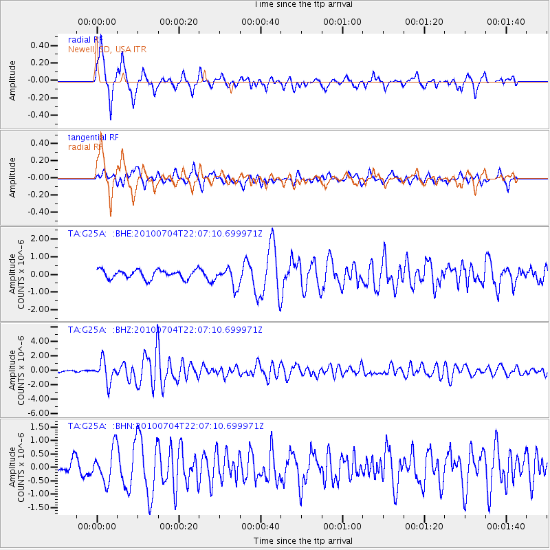
Earthquake location: Near East Coast Of Honshu, Japan
Earthquake latitude/longitude: 39.7/142.4
Earthquake time(UTC): 2010/07/04 (185) 21:55:51 GMT
Earthquake Depth: 27 km
Earthquake Magnitude: 6.4 MB, 6.1 MS, 6.3 MW, 6.2 MW
Earthquake Catalog/Contributor: WHDF/NEIC
Network: TA USArray Transportable Network (new EarthScope stations)
Station: G25A Newell, SD, USA
Lat/Lon: 45.19 N/103.42 W
Elevation: 894 m
Distance: 76.9 deg
Az: 41.455 deg
Baz: 313.75 deg
Ray Param: 0.050628953
Estimated Moho Depth: 37.25 km
Estimated Crust Vp/Vs: 2.00
Assumed Crust Vp: 6.242 km/s
Estimated Crust Vs: 3.129 km/s
Estimated Crust Poisson's Ratio: 0.33
Radial Match: 88.033516 %
Radial Bump: 340
Transverse Match: 74.54078 %
Transverse Bump: 400
SOD ConfigId: 319893
Insert Time: 2011-01-05 00:26:55.801 +0000
GWidth: 2.5
Max Bumps: 400
Tol: 0.001

Signal To Noise

ChannelStoNSTALTA
TA:G25A: :BHZ:20100704T22:07:10.699971Z15.1758131.5249767E-61.0048732E-7
TA:G25A: :BHN:20100704T22:07:10.699971Z2.92393886.490113E-72.2196474E-7
TA:G25A: :BHE:20100704T22:07:10.699971Z2.26441295.565521E-72.4578208E-7
Arrivals
Ps6.1 SECOND
PpPs17 SECOND
PsPs/PpSs24 SECOND