D28A Regan, ND, USA - Earthquake Result Viewer
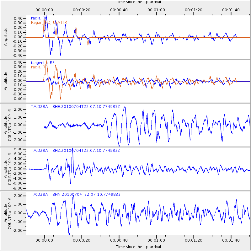
Earthquake location: Near East Coast Of Honshu, Japan
Earthquake latitude/longitude: 39.7/142.4
Earthquake time(UTC): 2010/07/04 (185) 21:55:51 GMT
Earthquake Depth: 27 km
Earthquake Magnitude: 6.4 MB, 6.1 MS, 6.3 MW, 6.2 MW
Earthquake Catalog/Contributor: WHDF/NEIC
Network: TA USArray Transportable Network (new EarthScope stations)
Station: D28A Regan, ND, USA
Lat/Lon: 47.19 N/100.57 W
Elevation: 621 m
Distance: 76.9 deg
Az: 38.567 deg
Baz: 315.146 deg
Ray Param: 0.050620813
Estimated Moho Depth: 17.5 km
Estimated Crust Vp/Vs: 1.66
Assumed Crust Vp: 6.438 km/s
Estimated Crust Vs: 3.878 km/s
Estimated Crust Poisson's Ratio: 0.22
Radial Match: 91.413475 %
Radial Bump: 332
Transverse Match: 80.49181 %
Transverse Bump: 400
SOD ConfigId: 319893
Insert Time: 2011-01-05 00:28:08.569 +0000
GWidth: 2.5
Max Bumps: 400
Tol: 0.001

Signal To Noise

ChannelStoNSTALTA
TA:D28A: :BHZ:20100704T22:07:10.774983Z18.8990361.9532918E-61.0335403E-7
TA:D28A: :BHN:20100704T22:07:10.774983Z2.95210176.529492E-72.2118114E-7
TA:D28A: :BHE:20100704T22:07:10.774983Z3.08882076.51269E-72.1084713E-7
Arrivals
Ps1.9 SECOND
PpPs7.0 SECOND
PsPs/PpSs8.8 SECOND