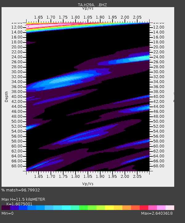
H29A Onida, SD, USA - Earthquake Result Viewer
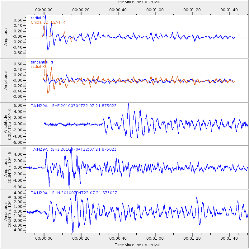
Earthquake location: Near East Coast Of Honshu, Japan
Earthquake latitude/longitude: 39.7/142.4
Earthquake time(UTC): 2010/07/04 (185) 21:55:51 GMT
Earthquake Depth: 27 km
Earthquake Magnitude: 6.4 MB, 6.1 MS, 6.3 MW, 6.2 MW
Earthquake Catalog/Contributor: WHDF/NEIC
Network: TA USArray Transportable Network (new EarthScope stations)
Station: H29A Onida, SD, USA
Lat/Lon: 44.63 N/100.21 W
Elevation: 548 m
Distance: 78.9 deg
Az: 40.228 deg
Baz: 315.749 deg
Ray Param: 0.049262863
Estimated Moho Depth: 11.5 km
Estimated Crust Vp/Vs: 1.61
Assumed Crust Vp: 6.53 km/s
Estimated Crust Vs: 4.062 km/s
Estimated Crust Poisson's Ratio: 0.18
Radial Match: 96.79932 %
Radial Bump: 314
Transverse Match: 90.99058 %
Transverse Bump: 400
SOD ConfigId: 319893
Insert Time: 2011-01-05 00:30:20.311 +0000
GWidth: 2.5
Max Bumps: 400
Tol: 0.001

Signal To Noise

ChannelStoNSTALTA
TA:H29A: :BHZ:20100704T22:07:21.87502Z18.2963732.0700807E-61.1314159E-7
TA:H29A: :BHN:20100704T22:07:21.87502Z4.81997541.0933423E-62.2683568E-7
TA:H29A: :BHE:20100704T22:07:21.87502Z6.3648461.2437742E-61.9541308E-7
Arrivals
Ps1.1 SECOND
PpPs4.4 SECOND
PsPs/PpSs5.5 SECOND