I30A Oacoma, SD, USA - Earthquake Result Viewer
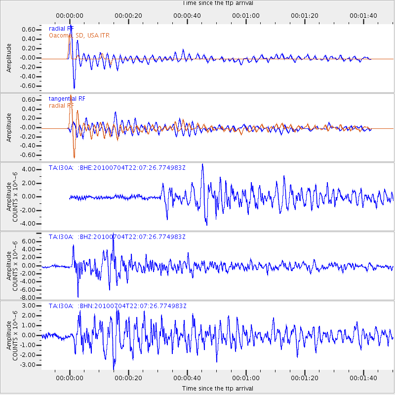
Earthquake location: Near East Coast Of Honshu, Japan
Earthquake latitude/longitude: 39.7/142.4
Earthquake time(UTC): 2010/07/04 (185) 21:55:51 GMT
Earthquake Depth: 27 km
Earthquake Magnitude: 6.4 MB, 6.1 MS, 6.3 MW, 6.2 MW
Earthquake Catalog/Contributor: WHDF/NEIC
Network: TA USArray Transportable Network (new EarthScope stations)
Station: I30A Oacoma, SD, USA
Lat/Lon: 43.91 N/99.43 W
Elevation: 549 m
Distance: 79.9 deg
Az: 40.317 deg
Baz: 316.312 deg
Ray Param: 0.04864387
Estimated Moho Depth: 27.5 km
Estimated Crust Vp/Vs: 1.68
Assumed Crust Vp: 6.53 km/s
Estimated Crust Vs: 3.899 km/s
Estimated Crust Poisson's Ratio: 0.22
Radial Match: 96.506195 %
Radial Bump: 400
Transverse Match: 93.298676 %
Transverse Bump: 400
SOD ConfigId: 319893
Insert Time: 2011-01-05 00:30:33.216 +0000
GWidth: 2.5
Max Bumps: 400
Tol: 0.001

Signal To Noise

ChannelStoNSTALTA
TA:I30A: :BHZ:20100704T22:07:26.774983Z15.2029792.1890041E-61.439852E-7
TA:I30A: :BHN:20100704T22:07:26.774983Z6.2008529.726913E-71.5686415E-7
TA:I30A: :BHE:20100704T22:07:26.774983Z7.44580031.1668184E-61.5670827E-7
Arrivals
Ps2.9 SECOND
PpPs11 SECOND
PsPs/PpSs14 SECOND