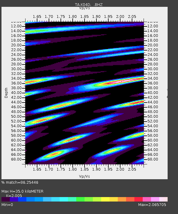
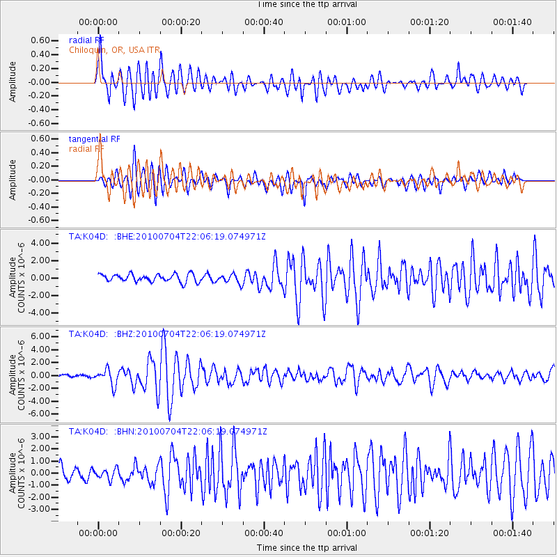
K04D Chiloquin, OR, USA - Earthquake Result Viewer

Earthquake location: Near East Coast Of Honshu, Japan
Earthquake latitude/longitude: 39.7/142.4
Earthquake time(UTC): 2010/07/04 (185) 21:55:51 GMT
Earthquake Depth: 27 km
Earthquake Magnitude: 6.4 MB, 6.1 MS, 6.3 MW, 6.2 MW
Earthquake Catalog/Contributor: WHDF/NEIC
Network: TA USArray Transportable Network (new EarthScope stations)
Station: K04D Chiloquin, OR, USA
Lat/Lon: 42.62 N/121.75 W
Elevation: 1315 m
Distance: 68.2 deg
Az: 52.241 deg
Baz: 304.265 deg
Ray Param: 0.05640539
Estimated Moho Depth: 35.0 km
Estimated Crust Vp/Vs: 2.01
Assumed Crust Vp: 6.597 km/s
Estimated Crust Vs: 3.291 km/s
Estimated Crust Poisson's Ratio: 0.33
Radial Match: 86.25446 %
Radial Bump: 400
Transverse Match: 84.61993 %
Transverse Bump: 400
SOD ConfigId: 319893
Insert Time: 2011-01-05 00:31:09.987 +0000
GWidth: 2.5
Max Bumps: 400
Tol: 0.001

Signal To Noise

ChannelStoNSTALTA
TA:K04D: :BHZ:20100704T22:06:19.074971Z7.99739031.2572492E-61.5720742E-7
TA:K04D: :BHN:20100704T22:06:19.074971Z1.10971824.3117083E-73.8854085E-7
TA:K04D: :BHE:20100704T22:06:19.074971Z1.2159835.351049E-74.400595E-7
Arrivals
Ps5.5 SECOND
PpPs15 SECOND
PsPs/PpSs21 SECOND