I05D Terrebonne, OR, USA - Earthquake Result Viewer
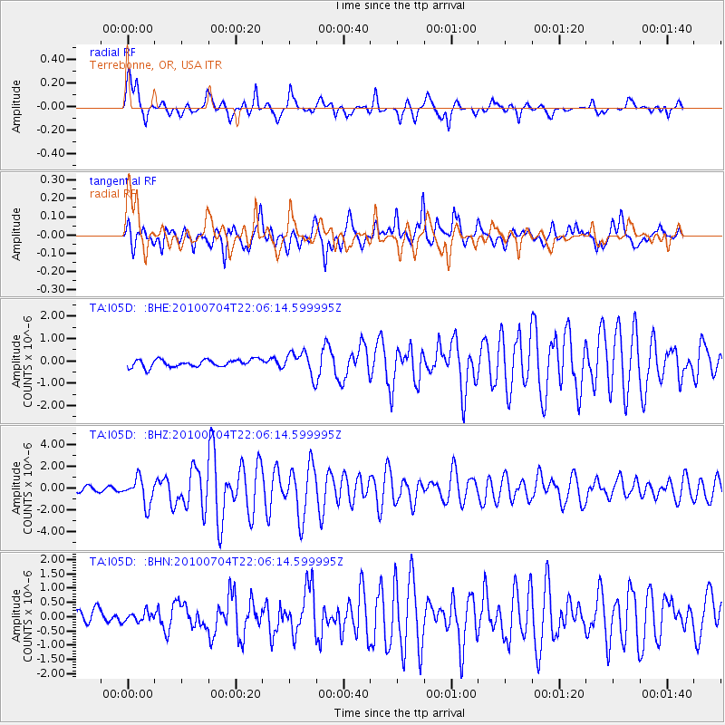
Earthquake location: Near East Coast Of Honshu, Japan
Earthquake latitude/longitude: 39.7/142.4
Earthquake time(UTC): 2010/07/04 (185) 21:55:51 GMT
Earthquake Depth: 27 km
Earthquake Magnitude: 6.4 MB, 6.1 MS, 6.3 MW, 6.2 MW
Earthquake Catalog/Contributor: WHDF/NEIC
Network: TA USArray Transportable Network (new EarthScope stations)
Station: I05D Terrebonne, OR, USA
Lat/Lon: 44.34 N/121.34 W
Elevation: 1546 m
Distance: 67.5 deg
Az: 50.527 deg
Baz: 303.903 deg
Ray Param: 0.056868657
Estimated Moho Depth: 16.75 km
Estimated Crust Vp/Vs: 1.63
Assumed Crust Vp: 6.597 km/s
Estimated Crust Vs: 4.048 km/s
Estimated Crust Poisson's Ratio: 0.20
Radial Match: 85.92742 %
Radial Bump: 400
Transverse Match: 82.52301 %
Transverse Bump: 400
SOD ConfigId: 319893
Insert Time: 2011-01-05 00:31:34.759 +0000
GWidth: 2.5
Max Bumps: 400
Tol: 0.001

Signal To Noise

ChannelStoNSTALTA
TA:I05D: :BHZ:20100704T22:06:14.599995Z6.0812461.2272313E-62.0180589E-7
TA:I05D: :BHN:20100704T22:06:14.599995Z0.63198371.6649454E-72.6344753E-7
TA:I05D: :BHE:20100704T22:06:14.599995Z3.16774185.2343466E-71.6523906E-7
Arrivals
Ps1.7 SECOND
PpPs6.4 SECOND
PsPs/PpSs8.1 SECOND