
V32A Arapaho, OK, USA - Earthquake Result Viewer
| ||||||||||||||||||
| ||||||||||||||||||
| ||||||||||||||||||
|
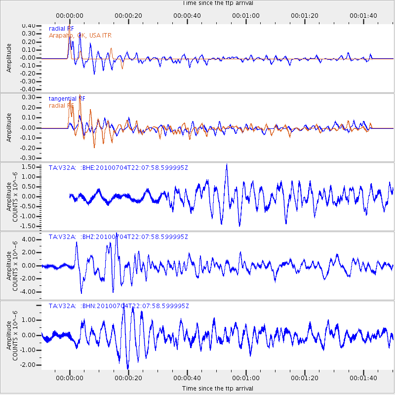
Signal To Noise
| Channel | StoN | STA | LTA |
| TA:V32A: :BHZ:20100704T22:07:58.599995Z | 12.40804 | 1.7616262E-6 | 1.4197458E-7 |
| TA:V32A: :BHN:20100704T22:07:58.599995Z | 2.4330666 | 4.6984877E-7 | 1.9310971E-7 |
| TA:V32A: :BHE:20100704T22:07:58.599995Z | 1.3499763 | 2.1867085E-7 | 1.6198126E-7 |
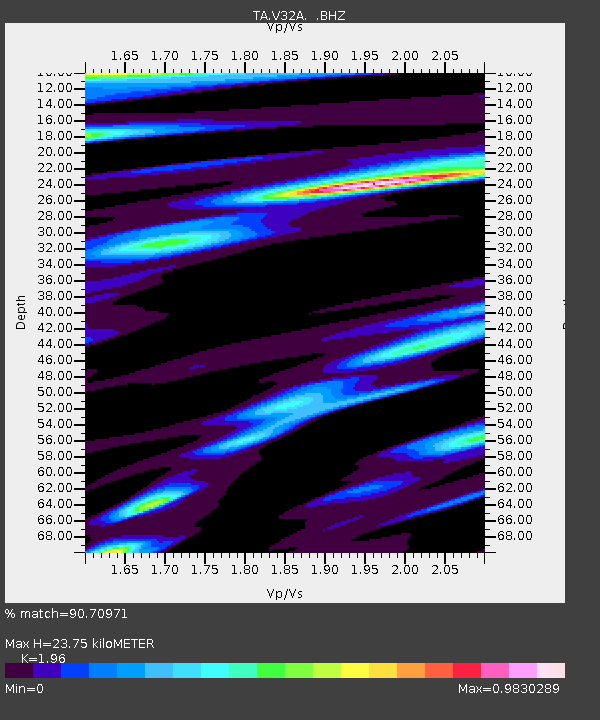
| Arrivals | |
| Ps | 3.7 SECOND |
| PpPs | 11 SECOND |
| PsPs/PpSs | 15 SECOND |

