
V34A Guthrie, OK, USA - Earthquake Result Viewer
| ||||||||||||||||||
| ||||||||||||||||||
| ||||||||||||||||||
|
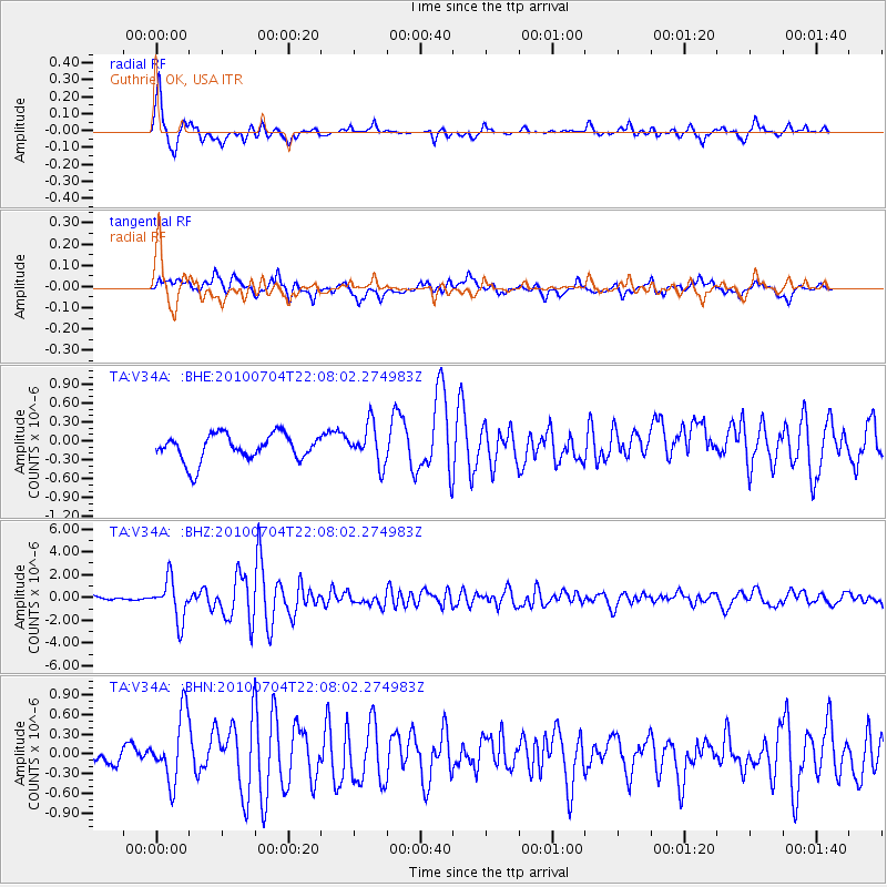
Signal To Noise
| Channel | StoN | STA | LTA |
| TA:V34A: :BHZ:20100704T22:08:02.274983Z | 11.770313 | 1.7743104E-6 | 1.5074453E-7 |
| TA:V34A: :BHN:20100704T22:08:02.274983Z | 3.0061853 | 5.157643E-7 | 1.7156772E-7 |
| TA:V34A: :BHE:20100704T22:08:02.274983Z | 1.4779112 | 3.1110105E-7 | 2.1050049E-7 |
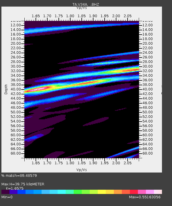
| Arrivals | |
| Ps | 4.2 SECOND |
| PpPs | 16 SECOND |
| PsPs/PpSs | 20 SECOND |

