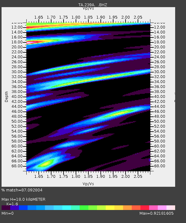
239A Gary, TX, USA - Earthquake Result Viewer

Earthquake location: Near East Coast Of Honshu, Japan
Earthquake latitude/longitude: 39.7/142.4
Earthquake time(UTC): 2010/07/04 (185) 21:55:51 GMT
Earthquake Depth: 27 km
Earthquake Magnitude: 6.4 MB, 6.1 MS, 6.3 MW, 6.2 MW
Earthquake Catalog/Contributor: WHDF/NEIC
Network: TA USArray Transportable Network (new EarthScope stations)
Station: 239A Gary, TX, USA
Lat/Lon: 32.02 N/94.47 W
Elevation: 100 m
Distance: 91.3 deg
Az: 45.342 deg
Baz: 319.755 deg
Ray Param: 0.04160845
Estimated Moho Depth: 18.0 km
Estimated Crust Vp/Vs: 1.60
Assumed Crust Vp: 6.245 km/s
Estimated Crust Vs: 3.903 km/s
Estimated Crust Poisson's Ratio: 0.18
Radial Match: 87.092804 %
Radial Bump: 292
Transverse Match: 74.50601 %
Transverse Bump: 400
SOD ConfigId: 319893
Insert Time: 2011-01-05 00:36:47.401 +0000
GWidth: 2.5
Max Bumps: 400
Tol: 0.001

Signal To Noise

ChannelStoNSTALTA
TA:239A: :BHZ:20100704T22:08:23.599995Z6.41256869.403411E-71.4664032E-7
TA:239A: :BHN:20100704T22:08:23.599995Z1.50733092.5378947E-71.6837011E-7
TA:239A: :BHE:20100704T22:08:23.599995Z1.48040742.6027317E-71.7581186E-7
Arrivals
Ps1.8 SECOND
PpPs7.3 SECOND
PsPs/PpSs9.1 SECOND