You are here: Home > Network List > US - United States National Seismic Network Stations List
> Station MNTX Cornudas Mountains, Texas, USA > Earthquake Result Viewer
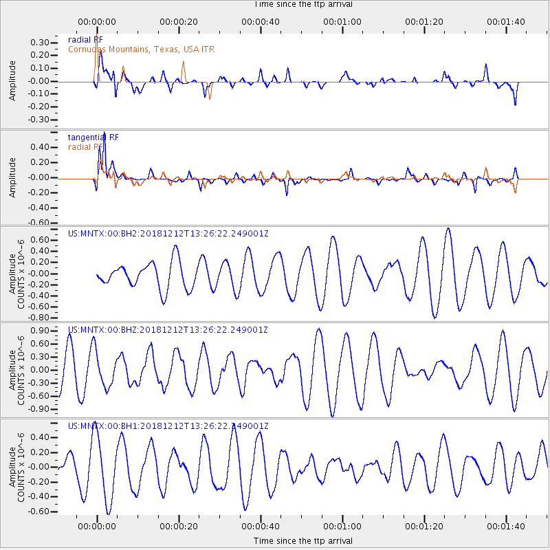
MNTX Cornudas Mountains, Texas, USA - Earthquake Result Viewer
*The percent match for this event was below the threshold and hence no stack was calculated.
| Earthquake location: |
Pacific-Antarctic Ridge |
| Earthquake latitude/longitude: |
-55.8/-128.5 |
| Earthquake time(UTC): |
2018/12/12 (346) 13:13:57 GMT |
| Earthquake Depth: |
10 km |
| Earthquake Magnitude: |
6.3 Mww |
| Earthquake Catalog/Contributor: |
NEIC PDE/us |
|
| Network: |
US United States National Seismic Network |
| Station: |
MNTX Cornudas Mountains, Texas, USA |
| Lat/Lon: |
31.70 N/105.38 W |
| Elevation: |
404 m |
|
| Distance: |
89.4 deg |
| Az: |
19.535 deg |
| Baz: |
192.798 deg |
| Ray Param: |
$rayparam |
*The percent match for this event was below the threshold and hence was not used in the summary stack. |
|
| Radial Match: |
52.89918 % |
| Radial Bump: |
395 |
| Transverse Match: |
69.221985 % |
| Transverse Bump: |
400 |
| SOD ConfigId: |
3201911 |
| Insert Time: |
2018-12-26 13:19:37.831 +0000 |
| GWidth: |
2.5 |
| Max Bumps: |
400 |
| Tol: |
0.001 |
|
Signal To Noise
| Channel | StoN | STA | LTA |
| US:MNTX:00:BHZ:20181212T13:26:22.249001Z | 1.5295961 | 4.002863E-7 | 2.616941E-7 |
| US:MNTX:00:BH1:20181212T13:26:22.249001Z | 1.8671545 | 4.4372788E-7 | 2.3764926E-7 |
| US:MNTX:00:BH2:20181212T13:26:22.249001Z | 1.0819763 | 2.4602124E-7 | 2.2738139E-7 |
| Arrivals |
| Ps | |
| PpPs | |
| PsPs/PpSs | |


