X35A Drake, OK, USA - Earthquake Result Viewer
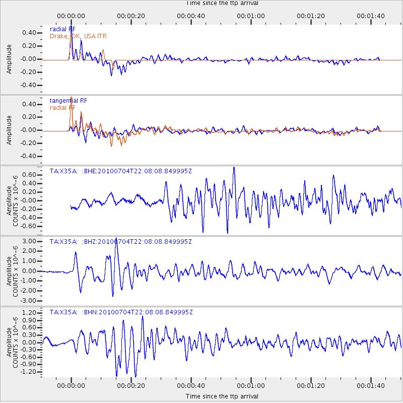
Earthquake location: Near East Coast Of Honshu, Japan
Earthquake latitude/longitude: 39.7/142.4
Earthquake time(UTC): 2010/07/04 (185) 21:55:51 GMT
Earthquake Depth: 27 km
Earthquake Magnitude: 6.4 MB, 6.1 MS, 6.3 MW, 6.2 MW
Earthquake Catalog/Contributor: WHDF/NEIC
Network: TA USArray Transportable Network (new EarthScope stations)
Station: X35A Drake, OK, USA
Lat/Lon: 34.40 N/96.97 W
Elevation: 300 m
Distance: 88.1 deg
Az: 45.372 deg
Baz: 318.391 deg
Ray Param: 0.042777754
Estimated Moho Depth: 21.25 km
Estimated Crust Vp/Vs: 2.07
Assumed Crust Vp: 6.426 km/s
Estimated Crust Vs: 3.108 km/s
Estimated Crust Poisson's Ratio: 0.35
Radial Match: 88.65822 %
Radial Bump: 400
Transverse Match: 76.24763 %
Transverse Bump: 400
SOD ConfigId: 319893
Insert Time: 2011-01-05 00:37:48.740 +0000
GWidth: 2.5
Max Bumps: 400
Tol: 0.001

Signal To Noise

ChannelStoNSTALTA
TA:X35A: :BHZ:20100704T22:08:08.849995Z12.1127621.0150318E-68.379854E-8
TA:X35A: :BHN:20100704T22:08:08.849995Z1.9381112.578837E-71.330593E-7
TA:X35A: :BHE:20100704T22:08:08.849995Z2.85836742.4581237E-78.599746E-8
Arrivals
Ps3.6 SECOND
PpPs10.0 SECOND
PsPs/PpSs14 SECOND