
X36A Centrahoma, OK, USA - Earthquake Result Viewer
| ||||||||||||||||||
| ||||||||||||||||||
| ||||||||||||||||||
|
Signal To Noise
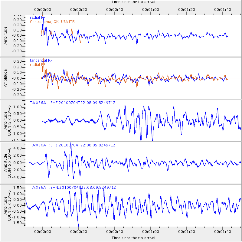
| Channel | StoN | STA | LTA |
| TA:X36A: :BHZ:20100704T22:08:09.824971Z | 10.776732 | 1.6103625E-6 | 1.4942957E-7 |
| TA:X36A: :BHN:20100704T22:08:09.824971Z | 2.5493186 | 4.4959737E-7 | 1.7635982E-7 |
| TA:X36A: :BHE:20100704T22:08:09.824971Z | 3.16871 | 3.762725E-7 | 1.1874627E-7 |
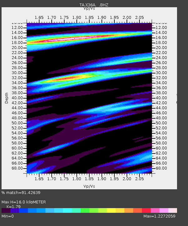
| Arrivals | |
| Ps | 2.0 SECOND |
| PpPs | 6.8 SECOND |
| PsPs/PpSs | 8.8 SECOND |

