You are here: Home > Network List > IW - Intermountain West Stations List
> Station MOOW Moose Ponds, Wyoming, USA > Earthquake Result Viewer
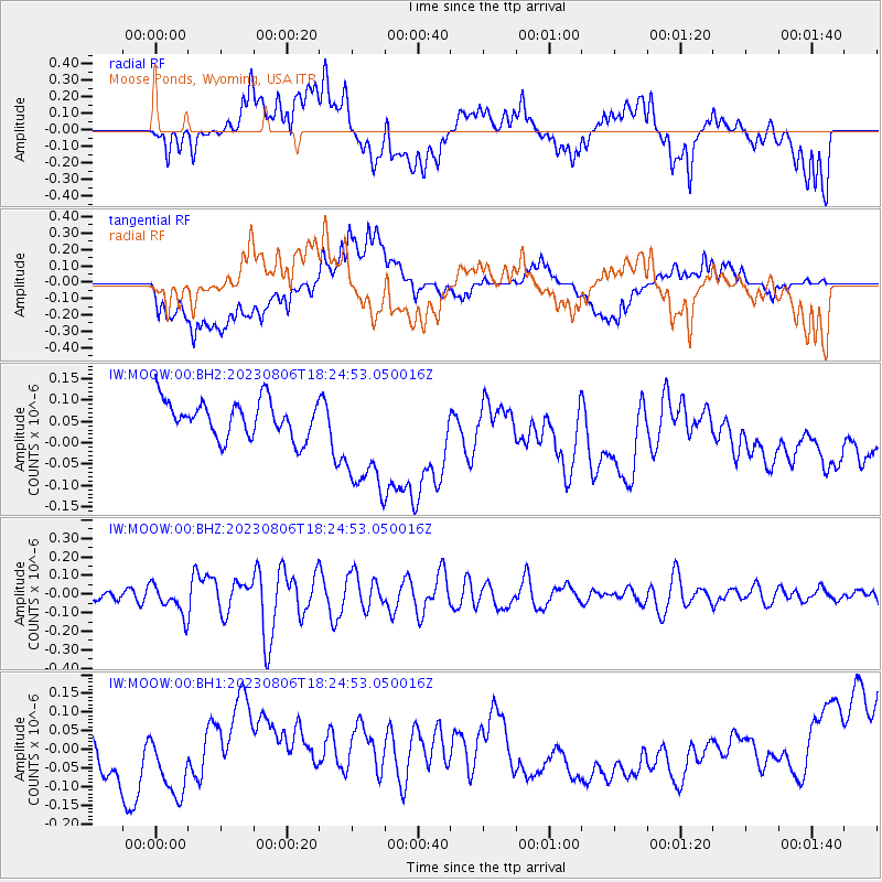
MOOW Moose Ponds, Wyoming, USA - Earthquake Result Viewer
*The percent match for this event was below the threshold and hence no stack was calculated.
| Earthquake location: |
Kyushu, Japan |
| Earthquake latitude/longitude: |
30.8/131.4 |
| Earthquake time(UTC): |
2023/08/06 (218) 18:12:41 GMT |
| Earthquake Depth: |
13 km |
| Earthquake Magnitude: |
5.5 Mww |
| Earthquake Catalog/Contributor: |
NEIC PDE/us |
|
| Network: |
IW Intermountain West |
| Station: |
MOOW Moose Ponds, Wyoming, USA |
| Lat/Lon: |
43.75 N/110.74 W |
| Elevation: |
2128 m |
|
| Distance: |
86.6 deg |
| Az: |
39.925 deg |
| Baz: |
310.332 deg |
| Ray Param: |
$rayparam |
*The percent match for this event was below the threshold and hence was not used in the summary stack. |
|
| Radial Match: |
38.600597 % |
| Radial Bump: |
400 |
| Transverse Match: |
24.929071 % |
| Transverse Bump: |
400 |
| SOD ConfigId: |
31937991 |
| Insert Time: |
2023-08-20 18:27:30.128 +0000 |
| GWidth: |
2.5 |
| Max Bumps: |
400 |
| Tol: |
0.001 |
|
Signal To Noise
| Channel | StoN | STA | LTA |
| IW:MOOW:00:BHZ:20230806T18:24:53.050016Z | 2.1008494 | 8.186904E-8 | 3.8969493E-8 |
| IW:MOOW:00:BH1:20230806T18:24:53.050016Z | 0.7242404 | 7.7735514E-8 | 1.0733385E-7 |
| IW:MOOW:00:BH2:20230806T18:24:53.050016Z | 3.2735922 | 1.3979441E-7 | 4.270367E-8 |
| Arrivals |
| Ps | |
| PpPs | |
| PsPs/PpSs | |


