N34A Lincoln, NE, USA - Earthquake Result Viewer
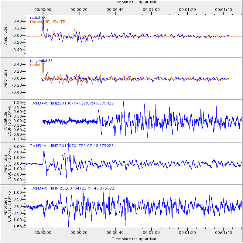
Earthquake location: Near East Coast Of Honshu, Japan
Earthquake latitude/longitude: 39.7/142.4
Earthquake time(UTC): 2010/07/04 (185) 21:55:51 GMT
Earthquake Depth: 27 km
Earthquake Magnitude: 6.4 MB, 6.1 MS, 6.3 MW, 6.2 MW
Earthquake Catalog/Contributor: WHDF/NEIC
Network: TA USArray Transportable Network (new EarthScope stations)
Station: N34A Lincoln, NE, USA
Lat/Lon: 40.84 N/96.50 W
Elevation: 401 m
Distance: 83.6 deg
Az: 40.811 deg
Baz: 318.349 deg
Ray Param: 0.046053395
Estimated Moho Depth: 19.5 km
Estimated Crust Vp/Vs: 1.86
Assumed Crust Vp: 6.498 km/s
Estimated Crust Vs: 3.489 km/s
Estimated Crust Poisson's Ratio: 0.30
Radial Match: 92.94212 %
Radial Bump: 400
Transverse Match: 73.524536 %
Transverse Bump: 400
SOD ConfigId: 319893
Insert Time: 2011-01-05 00:39:26.210 +0000
GWidth: 2.5
Max Bumps: 400
Tol: 0.001

Signal To Noise

ChannelStoNSTALTA
TA:N34A: :BHZ:20100704T22:07:46.37502Z17.7812589.851723E-75.5405092E-8
TA:N34A: :BHN:20100704T22:07:46.37502Z3.16471342.7057044E-78.549603E-8
TA:N34A: :BHE:20100704T22:07:46.37502Z4.19428973.565216E-78.5001666E-8
Arrivals
Ps2.7 SECOND
PpPs8.4 SECOND
PsPs/PpSs11 SECOND