
O33A Hebron, NE, USA - Earthquake Result Viewer
| ||||||||||||||||||
| ||||||||||||||||||
| ||||||||||||||||||
|
Signal To Noise
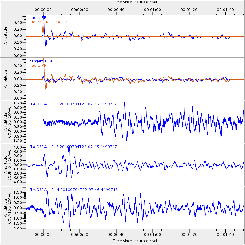
| Channel | StoN | STA | LTA |
| TA:O33A: :BHZ:20100704T22:07:46.449971Z | 10.044789 | 1.3023524E-6 | 1.2965454E-7 |
| TA:O33A: :BHN:20100704T22:07:46.449971Z | 4.978891 | 6.8662195E-7 | 1.379066E-7 |
| TA:O33A: :BHE:20100704T22:07:46.449971Z | 4.402996 | 4.1471966E-7 | 9.4190334E-8 |
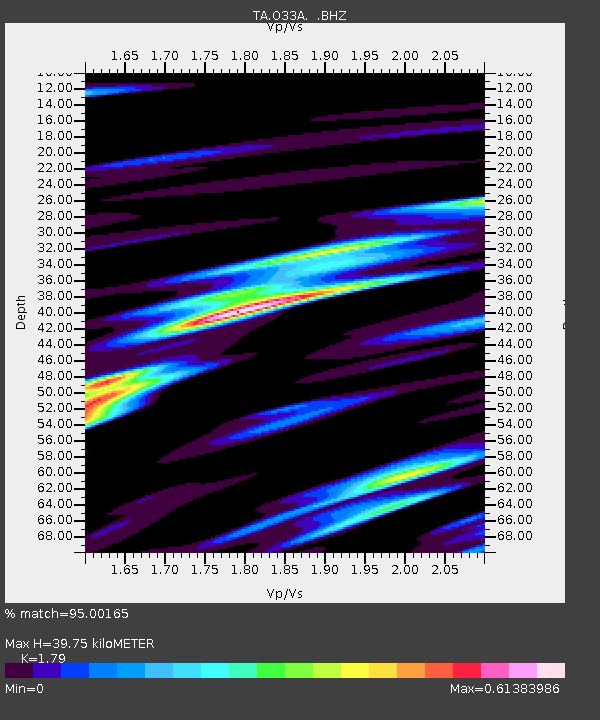
| Arrivals | |
| Ps | 5.0 SECOND |
| PpPs | 17 SECOND |
| PsPs/PpSs | 22 SECOND |

