
V36A Jenks, OK, USA - Earthquake Result Viewer
| ||||||||||||||||||
| ||||||||||||||||||
| ||||||||||||||||||
|
Signal To Noise
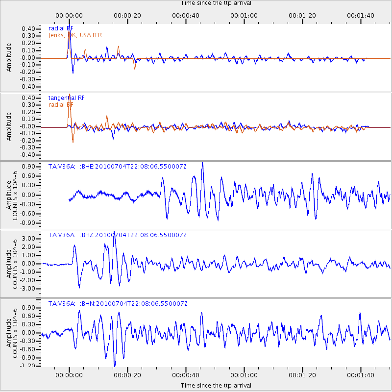
| Channel | StoN | STA | LTA |
| TA:V36A: :BHZ:20100704T22:08:06.550007Z | 16.086542 | 1.2770478E-6 | 7.93861E-8 |
| TA:V36A: :BHN:20100704T22:08:06.550007Z | 4.1194134 | 3.7028806E-7 | 8.988854E-8 |
| TA:V36A: :BHE:20100704T22:08:06.550007Z | 3.9872234 | 3.2368627E-7 | 8.118087E-8 |
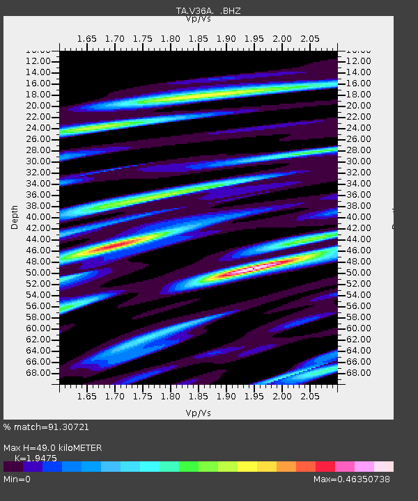
| Arrivals | |
| Ps | 7.3 SECOND |
| PpPs | 22 SECOND |
| PsPs/PpSs | 29 SECOND |

