
M35A Neola, IA, USA - Earthquake Result Viewer
| ||||||||||||||||||
| ||||||||||||||||||
| ||||||||||||||||||
|
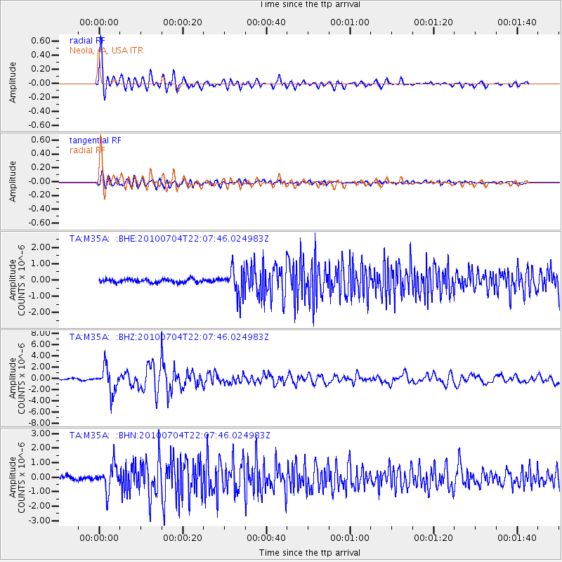
Signal To Noise
| Channel | StoN | STA | LTA |
| TA:M35A: :BHZ:20100704T22:07:46.024983Z | 28.012127 | 2.2335569E-6 | 7.973535E-8 |
| TA:M35A: :BHN:20100704T22:07:46.024983Z | 7.6705785 | 8.705867E-7 | 1.13496874E-7 |
| TA:M35A: :BHE:20100704T22:07:46.024983Z | 7.698424 | 7.992311E-7 | 1.038175E-7 |
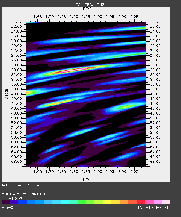
| Arrivals | |
| Ps | 3.8 SECOND |
| PpPs | 13 SECOND |
| PsPs/PpSs | 16 SECOND |

