You are here: Home > Network List > IW - Intermountain West Stations List
> Station MOOW Moose Ponds, Wyoming, USA > Earthquake Result Viewer
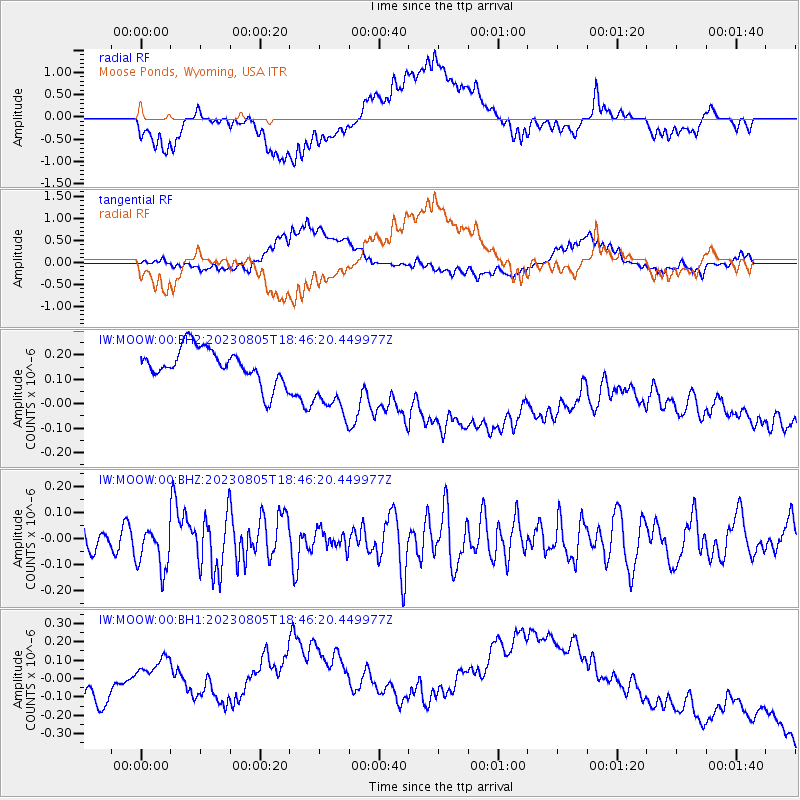
MOOW Moose Ponds, Wyoming, USA - Earthquake Result Viewer
*The percent match for this event was below the threshold and hence no stack was calculated.
| Earthquake location: |
Northeastern China |
| Earthquake latitude/longitude: |
37.2/116.4 |
| Earthquake time(UTC): |
2023/08/05 (217) 18:33:59 GMT |
| Earthquake Depth: |
18 km |
| Earthquake Magnitude: |
5.4 Mww |
| Earthquake Catalog/Contributor: |
NEIC PDE/us |
|
| Network: |
IW Intermountain West |
| Station: |
MOOW Moose Ponds, Wyoming, USA |
| Lat/Lon: |
43.75 N/110.74 W |
| Elevation: |
2128 m |
|
| Distance: |
88.8 deg |
| Az: |
32.091 deg |
| Baz: |
324.188 deg |
| Ray Param: |
$rayparam |
*The percent match for this event was below the threshold and hence was not used in the summary stack. |
|
| Radial Match: |
19.857067 % |
| Radial Bump: |
400 |
| Transverse Match: |
35.928947 % |
| Transverse Bump: |
400 |
| SOD ConfigId: |
31937991 |
| Insert Time: |
2023-08-22 14:27:46.713 +0000 |
| GWidth: |
2.5 |
| Max Bumps: |
400 |
| Tol: |
0.001 |
|
Signal To Noise
| Channel | StoN | STA | LTA |
| IW:MOOW:00:BHZ:20230805T18:46:20.449977Z | 2.3619416 | 8.3503174E-8 | 3.5353615E-8 |
| IW:MOOW:00:BH1:20230805T18:46:20.449977Z | 1.2918289 | 4.3963448E-7 | 3.4031942E-7 |
| IW:MOOW:00:BH2:20230805T18:46:20.449977Z | 2.264663 | 1.6263851E-7 | 7.181577E-8 |
| Arrivals |
| Ps | |
| PpPs | |
| PsPs/PpSs | |


