U36A Oologah, OK, USA - Earthquake Result Viewer
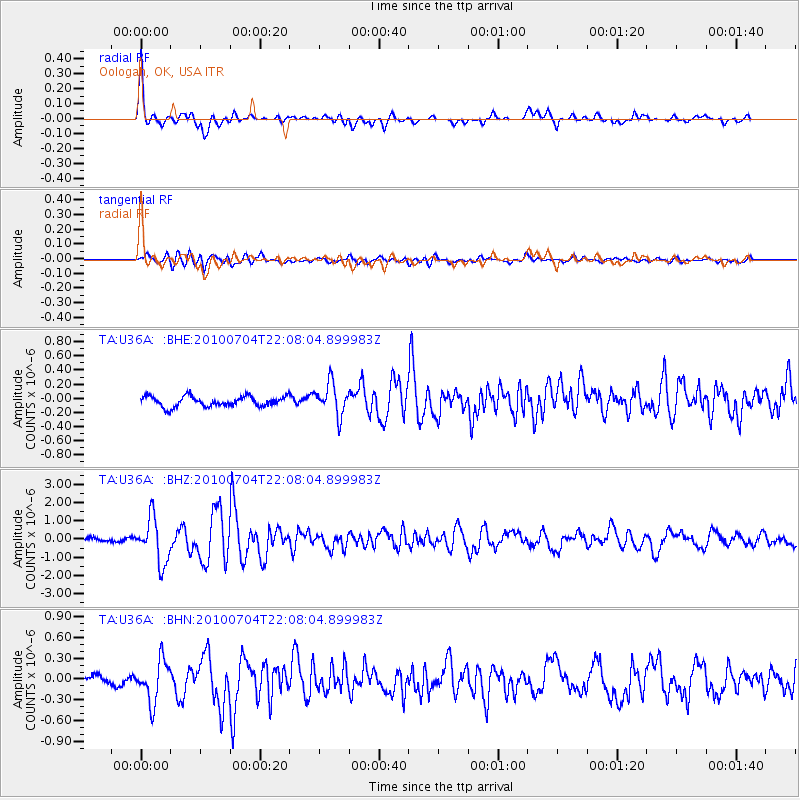
Earthquake location: Near East Coast Of Honshu, Japan
Earthquake latitude/longitude: 39.7/142.4
Earthquake time(UTC): 2010/07/04 (185) 21:55:51 GMT
Earthquake Depth: 27 km
Earthquake Magnitude: 6.4 MB, 6.1 MS, 6.3 MW, 6.2 MW
Earthquake Catalog/Contributor: WHDF/NEIC
Network: TA USArray Transportable Network (new EarthScope stations)
Station: U36A Oologah, OK, USA
Lat/Lon: 36.39 N/95.73 W
Elevation: 187 m
Distance: 87.3 deg
Az: 43.296 deg
Baz: 319.024 deg
Ray Param: 0.043381583
Estimated Moho Depth: 21.75 km
Estimated Crust Vp/Vs: 1.65
Assumed Crust Vp: 6.53 km/s
Estimated Crust Vs: 3.952 km/s
Estimated Crust Poisson's Ratio: 0.21
Radial Match: 89.81003 %
Radial Bump: 382
Transverse Match: 79.35357 %
Transverse Bump: 400
SOD ConfigId: 319893
Insert Time: 2011-01-05 00:42:05.495 +0000
GWidth: 2.5
Max Bumps: 400
Tol: 0.001

Signal To Noise

ChannelStoNSTALTA
TA:U36A: :BHZ:20100704T22:08:04.899983Z13.9135441.2351599E-68.877392E-8
TA:U36A: :BHN:20100704T22:08:04.899983Z5.81177762.9719365E-75.113645E-8
TA:U36A: :BHE:20100704T22:08:04.899983Z3.113532.2442396E-77.208023E-8
Arrivals
Ps2.2 SECOND
PpPs8.6 SECOND
PsPs/PpSs11 SECOND