You are here: Home > Network List > GM - US Geological Survey Networks Stations List
> Station IWM01 Jericho 2M Well Monitoring Station > Earthquake Result Viewer
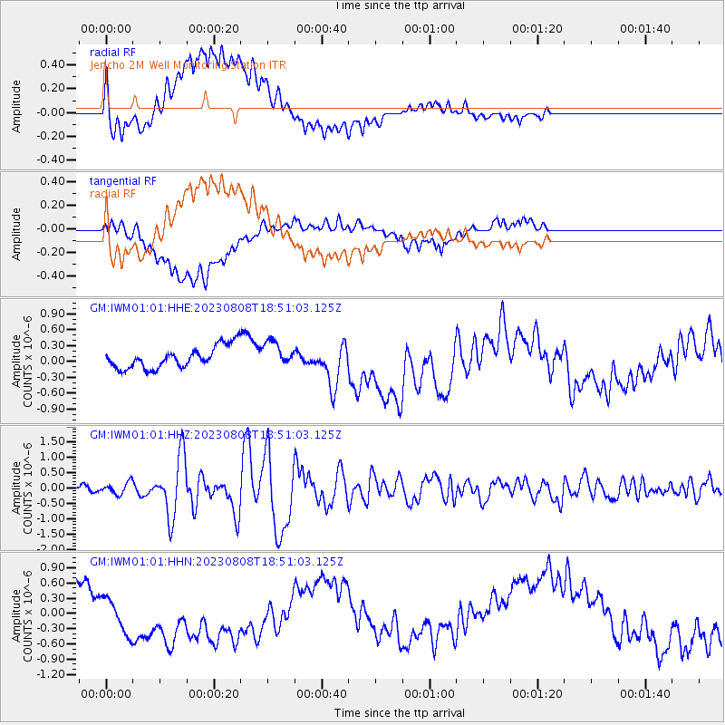
IWM01 Jericho 2M Well Monitoring Station - Earthquake Result Viewer
*The percent match for this event was below the threshold and hence no stack was calculated.
| Earthquake location: |
Tonga Islands |
| Earthquake latitude/longitude: |
-15.0/-173.0 |
| Earthquake time(UTC): |
2023/08/08 (220) 18:38:56 GMT |
| Earthquake Depth: |
120 km |
| Earthquake Magnitude: |
6.2 Mi |
| Earthquake Catalog/Contributor: |
NEIC PDE/pt |
|
| Network: |
GM US Geological Survey Networks |
| Station: |
IWM01 Jericho 2M Well Monitoring Station |
| Lat/Lon: |
36.73 N/96.53 W |
| Elevation: |
328 m |
|
| Distance: |
88.4 deg |
| Az: |
51.392 deg |
| Baz: |
250.036 deg |
| Ray Param: |
$rayparam |
*The percent match for this event was below the threshold and hence was not used in the summary stack. |
|
| Radial Match: |
51.92228 % |
| Radial Bump: |
400 |
| Transverse Match: |
45.765705 % |
| Transverse Bump: |
400 |
| SOD ConfigId: |
31937991 |
| Insert Time: |
2023-08-22 18:50:41.512 +0000 |
| GWidth: |
2.5 |
| Max Bumps: |
400 |
| Tol: |
0.001 |
|
Signal To Noise
| Channel | StoN | STA | LTA |
| GM:IWM01:01:HHZ:20230808T18:51:03.125Z | 1.9428698 | 1.8954131E-7 | 9.755739E-8 |
| GM:IWM01:01:HHN:20230808T18:51:03.125Z | 1.6594456 | 4.7212166E-7 | 2.8450563E-7 |
| GM:IWM01:01:HHE:20230808T18:51:03.125Z | 1.186336 | 2.3957384E-7 | 2.0194435E-7 |
| Arrivals |
| Ps | |
| PpPs | |
| PsPs/PpSs | |


