
STOR Enumclaw, WA, USA - Earthquake Result Viewer
| ||||||||||||||||||
| ||||||||||||||||||
| ||||||||||||||||||
|
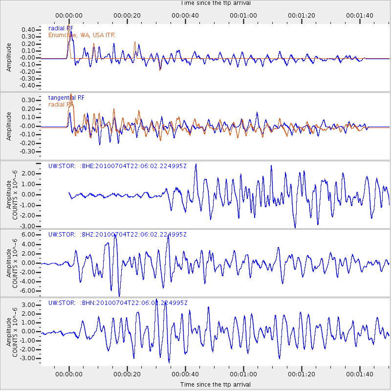
Signal To Noise
| Channel | StoN | STA | LTA |
| UW:STOR: :BHZ:20100704T22:06:02.224995Z | 18.166592 | 1.7014875E-6 | 9.366025E-8 |
| UW:STOR: :BHN:20100704T22:06:02.224995Z | 3.2356145 | 4.578575E-7 | 1.4150558E-7 |
| UW:STOR: :BHE:20100704T22:06:02.224995Z | 2.6537116 | 3.02761E-7 | 1.1408964E-7 |
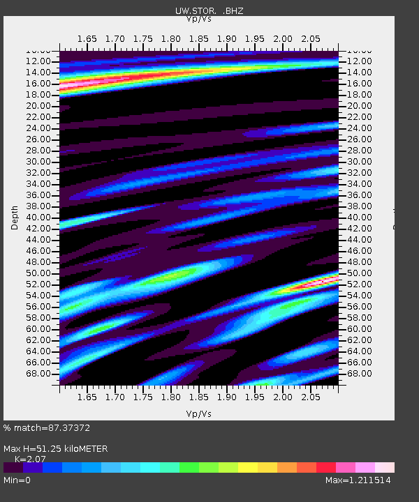
| Arrivals | |
| Ps | 8.6 SECOND |
| PpPs | 23 SECOND |
| PsPs/PpSs | 32 SECOND |

