PASS Maple Falls, WA, USA - Earthquake Result Viewer
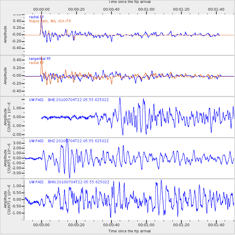
Earthquake location: Near East Coast Of Honshu, Japan
Earthquake latitude/longitude: 39.7/142.4
Earthquake time(UTC): 2010/07/04 (185) 21:55:51 GMT
Earthquake Depth: 27 km
Earthquake Magnitude: 6.4 MB, 6.1 MS, 6.3 MW, 6.2 MW
Earthquake Catalog/Contributor: WHDF/NEIC
Network: UW Pacific Northwest Regional Seismic Network
Station: PASS Maple Falls, WA, USA
Lat/Lon: 49.00 N/122.09 W
Elevation: 174 m
Distance: 64.6 deg
Az: 46.545 deg
Baz: 301.744 deg
Ray Param: 0.058808483
Estimated Moho Depth: 11.25 km
Estimated Crust Vp/Vs: 1.60
Assumed Crust Vp: 6.566 km/s
Estimated Crust Vs: 4.104 km/s
Estimated Crust Poisson's Ratio: 0.18
Radial Match: 83.002426 %
Radial Bump: 400
Transverse Match: 69.40057 %
Transverse Bump: 400
SOD ConfigId: 319893
Insert Time: 2011-01-05 00:47:35.619 +0000
GWidth: 2.5
Max Bumps: 400
Tol: 0.001

Signal To Noise

ChannelStoNSTALTA
UW:PASS: :BHZ:20100704T22:05:55.62502Z11.981919.814293E-78.190925E-8
UW:PASS: :BHN:20100704T22:05:55.62502Z2.14335972.7937165E-71.3034287E-7
UW:PASS: :BHE:20100704T22:05:55.62502Z3.7768593.466137E-79.1772996E-8
Arrivals
Ps1.1 SECOND
PpPs4.2 SECOND
PsPs/PpSs5.3 SECOND